TALES FROM THE TRAIL (AND SOMETIMES THE ROAD TOO)

Monday, May 14, 2012

Sitton Peak

This morning I drove up Ortega Highway for a run with a veteran trail runner, Steve Harvey.  He showed me trails I’ve never heard of, mostly single-track, in the San Mateo Wilderness.  Colorful spring flowers dotted the trail edges.  A welcomed cool breeze blew occasionally beneath a hot sun on often exposed trails.  The trail markers reminded me of make-shift grave markers. 

I got lots of advice on my training plan for Twin Peaks.  And right now I’m feeling a little more confident about what I signed myself up for.  I’m so grateful for this run and the knowledge and confidence I gained.  I am now armed with “I can do it.”  This is opposed to “I’m not sure I can do it.”  Or worse yet, “I doubt I can do it.” 

We ran past a helicopter rotor on the mountain floor.  I couldn’t help imagine the helicopter plummeting down.  You really never know what you’ll come across trail running.  Helicopter parts was a first for me.  We also came to yet another “Four Corners.”  But this one was the meeting of FIVE trails.  LOL.  Then we climbed a foot sliding steep trail to Sitton Peak, where we did some sittin’.  Smile.  The 360 degree views of wilderness was awe-inspiring. 

One piece of advice Steve gave me was to find a good technical downhill and work on really opening up on it.  He said that I won’t run the technical downhills that fast in an ultra, but I’ll run them more confidentially.  We ran a technical downhill on the way back when Steve took off surprisingly fast, hoping from side to side for the best path.  He disappeared from sight in an instant.  I have considered myself a decent technical down hill runner, in fact, this is pretty much my strong point.  This morning I had to push it to catch Steve.  I focused hard, several steps ahead and ran it much faster than I normally would have.  It was a blast!

San Mateo Wilderness with grave-marker-like trail markers:

Sitton Peak:

Running back to the trailhead on trails less-traveled:

It really didn’t seem like this much work! : )My Activities Bear Cyn Sitton Peak Loop 5-14-2012, Elevation - DistanceMy Activities Bear Cyn Sitton Peak Loop 5-14-2012

Friday, May 11, 2012

2012 Quests

Unlike previous years, I did not decide on my races or any other running goals at the beginning of 2012.  It has taken me until May to mark out my quests for the year.  Some of them I have already conquered – of course Calico, my favorite race of the year, Horsethief Repeats, Meadows Repeats, Big Baz’s 21k and his SJT 50k as well.  But more than half of 2012 remains.  And thus, I decided to get my “list” down.

These are my quests for the remainder of 2012:

1) Tides to Towers Run (A run from my house down to the beach to the Towers on Santiago Peak) 29+ miles

2) A Tides to Towers and back to Tides Run, 58 miles

3) Nanny Goat’s 24 Hour Trail Race, end of May, to benefit the Wounded Warriors (see right top Current Project for my pledge page)

4)  Camp Pendleton Mud Run; I had sworn off mud runs a while back, but with two friends running it, I decided to go ahead and get muddy in 2012.  Plus, Camp Pendleton has great runs.

5) Twin Peaks Ultra, 50 miles in the Saddleback mountains with 15,000’+ of elevation gain (yikes).  I’ve got some time – October 13.

6)  Not sure yet, but if I can afford it, I have an “F” (as in DNF),  that I’d like to make up by running the Bulldog 50k in August. (This will take some heat training).

7) And though I’m not yet registered, I definitely plan on running the Saddleback Marathon again this year in November. (This is my 2nd favorite race of the year).

8) And finally . . . run 2,000 annual miles.

As far as number of races, 2012 does not have a great number, especially compared to previous years.  But the overall difficulty of my quests is much greater than all my trail running years combined.  I need to get into the best shape of my life for Twin Peaks, which calls for some life adjustments, which I can gladly make, but lack the discipline thus far.  Yes, I’m 47.  But I can get into the best shape of my life because you see, my prior “best shape of my life,” I was in my late twenties and a non-runner.  I would do anything NOT to run.  And though I was a swimmer back then (5 days a week, 5:30 in the morning before work) and did aerobic dance in the evenings, I was also immature (very) and I was a SMOKER.  Therefore, I think I can smoke my prior “best shape in my life.”   I am not questing the impossible.

The week after Nanny Goat, I will begin a rigid training plan to get myself ready.  I hope to drop 20 pounds by the end of summer as well, and get myself on a diet richer in fruits and vegetables. 

Twin Peaks is why I’m running runs like I ran this morning (and this afternoon – I got a late morning start, and didn’t finish until about 2:30 pm).  My plan for today’s run:  up and down, up and down, up and down, up and down.  I ran up steep inclines, ran down technical downhills, then back up again.  I pretty much zig-zagged Aliso / Wood Canyons (though the satellite doesn’t look much like a zig-zag).  I enjoyed myself immensely.  More importantly, I planned my fluids perfectly.  And even more importantly than that, I finished with “gas still in the tank.”  That means I CAN WORK HARDER.  I just need the discipline to push myself more. 

Scenes from my 18 mile zig-zag run through Aliso/Wood Canyons:

Running up Mentally Sensitive (the first incline on the elevation profile below):

Enjoying the ridiculously steep run up:

Top of the World after clothing adjustments and a snack:

Chased this gopher snake down on Park Avenue Nature Trail (sorry little buddy, I just wanted a picture):

Running down Car Wreck Trail:

Running up Mathis:

A Brand New Bridge on Coyote Run Trail:

Running up the steps on Wood Creek:

Just in time to snap a photo of this rattler on the final stretch of this 18 mile run (last mile, on Aliso Creek Trail):

Satellite:My Activities Aliso Wood Zig-Zag Loop 5-11-2012

+3,027’ (922.63m) elevation gain / 18.03 miles (29k):My Activities Aliso Wood Zig-Zag Loop 5-11-2012, Elevation - Distance

Wednesday, May 9, 2012

The Big Loop (Counter-Clockwise)

I ran my regular Big Loop in Aliso/Wood Canyons this morning.  But I did something different.  I ran it counter-clockwise.  Instead of a short drastic climb closer to the beginning of the loop, I ran a more gradual climb, lasting several miles long.

And it was delightful.

And it was hot.

And it was stress free.

Gopher Greeting at Park’s Entrance:

Bunnies hopped across the trail.  Squirrels squealed from trees.  Stink bugs and Potato bugs crept along the dirt.  It was a lovely day in the wilderness.  Ended up that choosing the counter-clockwise direction was definitely best for today.  Why?  Because of the heat.  The canyon traps in the heat and it gets like you’re running through an oven.  Since I ran it fairly early, the heat was still bearable.  If I had run the canyon last, the afternoon heat would have been already settled in and baking.  On the other hand, running the ridge during the hotter part of the day provided lovely breezes.  And the best part was . . .  wait for it . . .

I got to run DOWN Mentally Sensitive.

Wood Canyon:

One of Two Staircases (both going UP) on Wood Creek:

I reached Top of the World feeling relaxed, nasal breathing the entire route.  Felt like I wasn’t physically working hard enough, which means I CAN work harder.  Smile  I love finding new techniques that make my run better, even if they are baby steps. 

By far the best part of today’s 13 mile run was my descent on Mentally Sensitive.  I have only run up that trail.  And I am here to report that I did not truly understand how steep that trail is until I ran down it today.  Wow!  I wasn’t sure how to run it.  Carefully for sure.  Some parts of the single track I debated whether I should sit and slide down on my butt.  I decided instead to kind of skip from side to side.  One steep portion was too short to get a skip started, so I ran tiny steps very quickly, nearly running straight off the cliff, which I wouldn’t have done because I would have forced myself to the ground in the opposite direction.  Glad I didn’t need to do that!  I was amazed to find myself still standing at the end of that slope. 

Exhilarating. 

Top of Mentally Sensitive:

Great, great fun (Mentally Sensitive):

I had so much energy left that I ran on in to the ranger station faster than I began my run this morning.  Chalk this baby up as one of those delightful, adventurous, easy runs. 

I soared over this critter on my way back to Wood Canyon (just a gopher snake, but a beaut still):

Elevation Profile of The Big Loop Counter-Clockwise:My Activities Aliso Big loop counter clockwise 5-9-2012, Elevation - Distance

Checking out.  Bye.  And thanks for reading! : )

Monday, May 7, 2012

Flora en route to Top of the World

DESPITE the joyful brutality of yesterday’s run, plus some red wine with dinner and after dinner, and waking at 6AM and getting breakfasts, lunches made, and  3 sons off to to school, I went for a trail run this morning.  I took my usual “shortish” run route, an out-and-back to Top of the World.  Perhaps I shall get “back  on track” (not the actual track, thank goodness), but my life, which means my mental and physical fitness.  I’m not saying that it’s trashed.  But it’s starting to slide.  It started to slide quite a few years ago when the U.S. economy took a tank.  But I kept going strong in the beginning, stronger than I would have imagined – that is until I went and registered for the 50k I just recently ran.  It was then during my pre-race freak-out that my diet (meaning the types of calories that I consumed as opposed to a calorie deficit plan) went out the window and my workout regimen started to fall down the mountain.  (No, that’s not fair.  It was the non-gym renewal that threw my workout regimen for a loop.  I feel like a spoiled child.  I mean, we can’t have everything we want.  I will have to do without a gym membership.  What’s important in life – NOT GYM MEMBERSHIPS! : )

And again, I digress.

The skies were blue and lovely and the weather nicely warm this morning around 10AM.  Perfect for a trip to Top of the World. I had a delightful time drenching my cotton t-shirt in salty sweat while snapping pictures of the flora along the way to Top of the World.  (Thanks Johann for your post on cotton-t’s – I was miserably chaffed after this past weekend.  Cotton was a welcomed relief today.)  Many of the flora photos didn’t all come out, mainly because I didn’t stand still to take snap the pictures.  Funny, though the hills are covered with a multitude of colors, mostly the yellowish flowered pictures turned out. 

Entering Wood Canyon before a climb up Cholla Trail to West Ridge:

My plan today was to take it nice and easy, put in some elevation gain and focus on breathing.  I also planned on, and did relish the heat.  I studied every runner that I came upon, and noticed they were all mouth breathing. How do you tell?  Open mouths.  And I daydreamed also.  I daydreamed about running the Transrockies Race one of these days – hopefully by age 50. (which is just a few short years away).  In other words, I lost the focus of the moment, the present.  But that’s okay.  I was still able to take in the beauty and notice the glorious spring flowers. 

I did spy a beautiful patch of purple flowers on Park Avenue Nature Trail.  I took a step in close to capture a photo and heard the rattles.  Did you know that rattlesnakes can’t hear well?  They feel your step vibrations in the earth.  I like that.  Makes me feel safer – like I don’t have to wear a cow bell to warn them.

When I heard the rattles, I stepped back, focused on my surroundings and stepped back in for a photo.  Rattle, rattle, rattle.  I backed away from the sound again quickly.  I couldn’t see the snake anywhere.  As such I decided I’d get a photo of those purple flowers another time.  (If I can’t see the snake, I’m not going to take my chances).

One more note before venturing on to the flora pictures.  I met my ex-marine, currently mixed-martial arts acquaintance on an obscure single track, exactly about the time I was thinking about his nasal breathing recommendation.  I smothered him with questions, which he had lots of answers.  Funny, I have military men in my family, and some of them runners.  They never mentioned nasal breathing to me.  Ultimate Fighter A-Rod answered lots of my questions, as he was visibly pleased that I felt improvement on the first try.  He said it would take at least a month to get nasal breathing down on the run.  And can you believe this?  The marines used to duct-tape his mouth shut because he had such a difficult time with nasal breathing.  Yikes!!!!!!!!!!!!

I am going way off track – but I suppose that’s the nature of a trail runner. Smile

Flora en route to Top of the World:ELEVATION

Glorious.  Simply glorious.

Sunday, May 6, 2012

Candy Store Run

My last run was last Sunday.  I recovered Monday.  Then my mood dipped pretty low.  I felt I needed to get my disordered life in order, so I spent much of my time organizing and cleaning and applying for more job positions. Hubby begged, “Please, go out and run!!!”  He didn’t say that because he wanted me out of the house.  The house was much cleaner after all – carpets vacuumed, floors swept, bills organized.  He just knows me.  He knows that runs would have lifted my spirits.  But it was gray and wet all week.  And that just made me more depressed.

In the interim, I did work on physical strength.  I did weight lifting, core work and general strength exercises nearly every day.  Then Saturday, I ran with my two youngest sons in the Kids Run The O.C. program.  I wore my New Balance Minimus trail shoes, which I can’t wear on the trail at all – they just aren’t substantial enough for technical terrain.  Anyway, even though the kids run was only one mile, I felt really good getting my legs moving.  The shoes were awesome, extremely comfy on the pavement.  It was all over too soon, and I couldn’t wait for today’s scheduled group run.

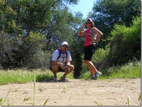
As many as 8 runners may have shown at 6:30 AM up in the local mountains.  Turns out, just two showed – me and my running friend, Michael P.

We started off on “The Candy Store” run on a cool morning, across the street from the candy store on Ortega Highway.  Right away I took us on a wrong turn, and we had to run back to the trail to continue onward.  Then once we got going on the correct, lush shady trail, I noticed that we were making a loop back to the parking lot.  I missed the turn off to Chiquita Trail!!  Missing the turn off added at least a quarter mile of technical uphill running (& back totaling 1/2 mile).

Back on track, running Chiquita Trail:

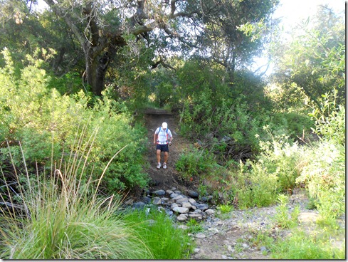
I found the trip up Chiquita delightful and wondered why it tore me apart so badly during the SJT 50k.  Of course, I had about twenty miles on my legs before making that trip!

The trail was empty on the out portion today.  We saw one hiker with hiking sticks making his way down.  He said this was, “The one trail that’s uphill on the way out and the way back.”  Seems so true.  But in reality it’s not.  Michael said that it’s like an Escher drawing. 

This time around, I was sure to search out Chiquita Falls, which I have failed to discover on my prior out-and-backs on this trail.  I found much less than I expected.  The falls were dry.

Chiquita Falls: 

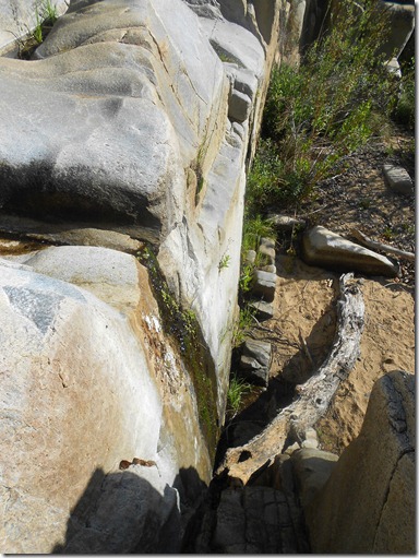
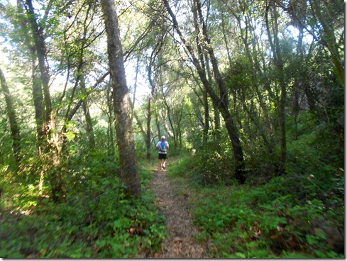
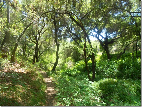
And then we ran more Chiquita trail, now mostly in the shade.  It was lovely, lush and green.  And most of that green in the undergrowth?  POISON OAK.  I brushed against it again and again.  Here’s to hoping my apparent immunity to the plant is still intact. 

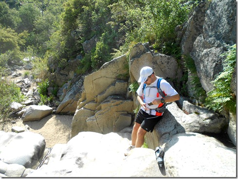
Arriving to the Chiquita trailhead, we had a choice to make.  1) Turnaround and run back, or 2) run a loop up San Juan Trail into Blue Jay Campground and back to Chiquita for the return trip.  We chose more mileage.  But first, Michael was attacked by fire ants as we tried to set up our cameras for “group” photos.  Ouch!

San Juan Trail, all ridiculously uphill and seemingly never ending was hot as well.  Mountain bikers made their way down the single track as I focused on not tripping over the rocky terrain.  At each turn I thought we were at the trailhead, only to find – No!  There was more to run in this heat.  Finally, we could see campgrounds and we simply ran right through the hillside into the campground, cutting off approximately a half mile from this run.

Mushrooms on San Juan Trail: 

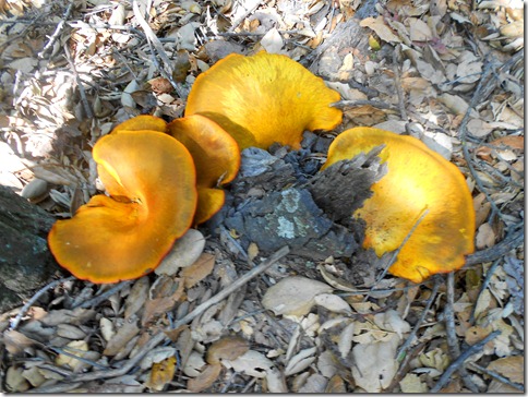
Blue Jay Campground seemed like a a 5 Star hotel to me.  A cool breeze blew.  There were trash cans to empty my pockets.  There were outhouses.  There were people.  And there was even running water. 

Well, the “down hill” trip back was not all down hill.  And when it was downhill, it was usually rocky and difficult to traverse.  On our way back to Chiquita, we came to the 4-way fork that I asked Michael to mark on our way in, because I lose my sense of direction there and have twice taken a wrong turn in the past.  Sure enough, I had no sense of direction when we arrived to the markers.  Had Michael not marked it, I would have surely chosen a wrong turn.  Funny.  Even with the markers, I began to run down the wrong trail!!

It was hot and I was growing extremely tired.  I wasn’t the only one.  Two mountain bikers (male & female) were sitting in the shade on the rocky trail, looking utterly fatigued.  They complained that they were “so hot,” and asked were they could find water.  They each had two bottles of water – one of them empty, the other with some water remaining.  When Michael pointed out the quickest way into Blue Jay, they took one look at that giant hill we had just run down and said, “No way, we’re not going up there for water.” 

It’s good the two were sitting in shade.  But they still had the trip to make back to the candy store.  I urged them to make the hike into Blue Jay.  “Just leave your bikes here,” I suggested.  They didn’t look like they’d be able to make the 8 plus miles back to the parking lot with the little water they had.  I hope the two rested a good long while and took our advice and hiked into Blue Jay.  We didn’t come across them again.

And we were off on the long, long HOT trip “down” Chiquita Trail with Michael taking the lead.  After a few miles, I suddenly came upon Michael standing on the single-track facing two hikers.  “We’ve got a rattler here,”’ he said.  I could hear its rattles from several feet away.  “Do you think I can get a picture?”  I asked and everyone laughed.  Turns out, I couldn’t get a picture.  And I was a little bummed about that.   

I really don’t fear rattlesnakes.  That’s not to say I don’t fear being stricken by one.  The best thing that can happen with a rattler is that you see it from a safe distance.  And we were at a safe distance.  As I moved in closer to see it coiled up in the brush, the two hikers nervously backed away.  I asked Michael if he could tell how big it was.  He said he thought it was about four feet long.  Well, I gave it an extra couple feet just in case, which means it’s striking distance would be about 3 feet or a little more.  The trail was about three feet wide, so I hiked up onto the bank on the opposite side of the trail as the frightened snake rattled away.  Now, not only would the rattlesnake have to strike more than three feet – he would have to strike me up hill!  (They can supposedly strike further down hill).  The two hikers looked at me like I was absolutely crazy.  Michael followed right behind me to pass the danger.  When I told the hikers that a rattler can only strike a little more than half it’s size, they too hiked up on the bank.  They looked back at us nervously.  “Just give them their space and you’ll be fine.” 

And then Michael and I continued to run – run in the heat and on the rocky, miserable terrain.  I was so dang tired, it would have felt good to walk the entire remaining miles, but with about three miles remaining, I wanted to get back ASAP.  My fluids were gone.

The “down hill” back to The Candy Store:

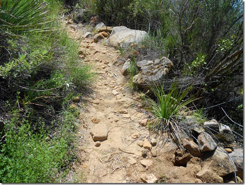
The last three miles were excruciatingly difficult.  We hiked some, we trotted some, we ran some.  Michael got out ahead often, but I could see him stop and look back.  It really was wonderfully miserable.  And when I thought I could no longer take it,  I looked around me to take in the beauty.  I dreamt of the ice-cold Gatorade in my truck.  And I refused to look at my garmin..  I also concentrated breathing through the nose, which worked very well since I ran so slowly.  It also helped to calm me down.  I tend to get a little anxious when the run gets super tough. 

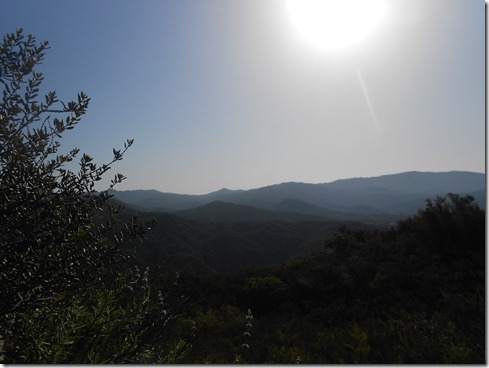
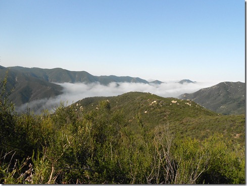
The Beauty that surrounded us:   

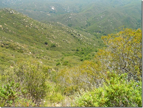
The last mile was truly hellish for me.  No fluids and extreme heat, not to mention uphill terrain, was not a good mix.  But as Michael said, “One foot in front of the other, eventually we’ll make it.”  I think he was a little worried about my directions, especially since it TOOK SO LONG to catch even a glimpse of the parking lot. 

What a beautiful sight it was to see signs of the parking lot.  I actually hollared, “Woo-Whoo!” when my feet hit that pavement.

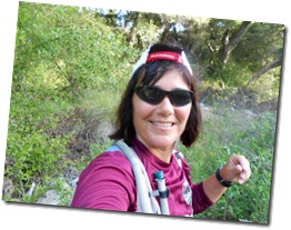
Finished (& a bit fatigued): 

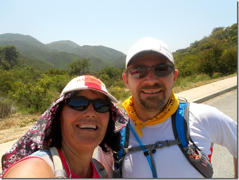
Elevation Profile (19.11 miles):My Activities Candy Store Run 5-6-2012, Elevation - Distance

And of course, the satellite (notice the wrong turn in the beginning, where the loop almost closes – LOL):My Activities Candy Store Run 5-6-2012