TALES FROM THE TRAIL (AND SOMETIMES THE ROAD TOO)

Saturday, August 16, 2014

Marijuana Bust

Friday I got out by noon and drove along the toll road for a run in Crystal Cove and Laguna Wilderness.  I had forgotten that nearly every time I run there I think I will never return.  Why?  Because so dang little shade.  Somehow, I always find my way back, and smack in the middle of a summer afternoon.

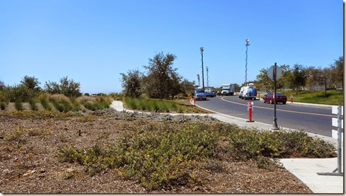
I arrived to Ridge Park, the hills in Irvine/Newport that overlook Newport Coast, amidst loud and chaotic excitement.  A couple helicopters flew above dumping marijuana plants onto a pile in the middle of the road.  Police vehicles and news vans crowded the streets.  To top it off, spectators drove in and out of the one opened area, laughing and talking, excited about the smell of marijuana in the air. 

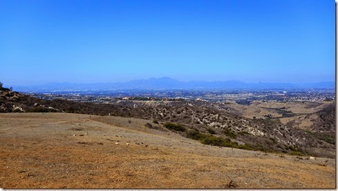
The marijuana fragrance was strong and stayed with me for a while on the dry hot trails.  I ran right through the commotion, thinking that law enforcement would stop me.  They didn’t, but I did notice a news camera following with its lens, and I thought, “FUDGE!  I don’t want to be on the news.”  (I didn’t quite use the word “fudge.”)

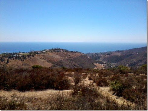
It wasn’t long before I was away from all the commotion.  I saw very few runners or hikers on the trails.  Understandably.  It was just too hot.  I wondered how on earth farmers were able to grow illegal crops in this mostly brown, exposed wilderness area.  How did they water the approximate 4,000 plants.  How were they going to harvest without being detected? 

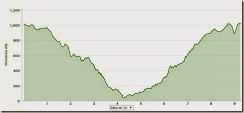
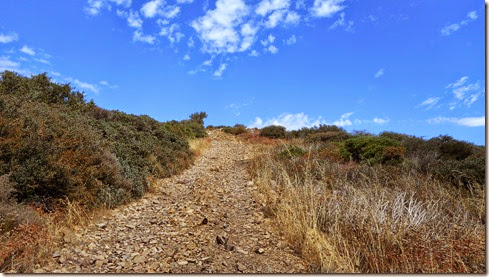
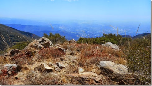
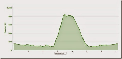
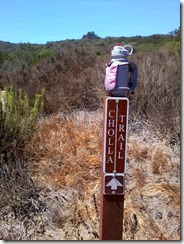
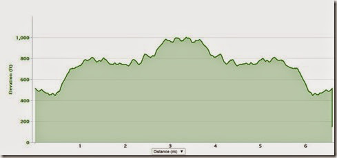
I arrived at the bottom taking No-Name Ridge and No-Dogs a little overheated.  I decided to take El Moro Canyon back up to Bommer Ridge (the shorter choice), scratching my original plans to run past the canyon and straight up to Moro Ridge.  I’m not sure the canyon route was the best choice.  I felt like I was running in an oven.  On a ridge I would have at least experienced a breeze.  

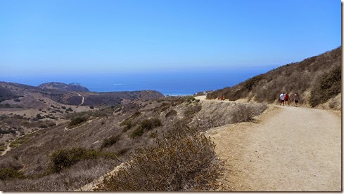
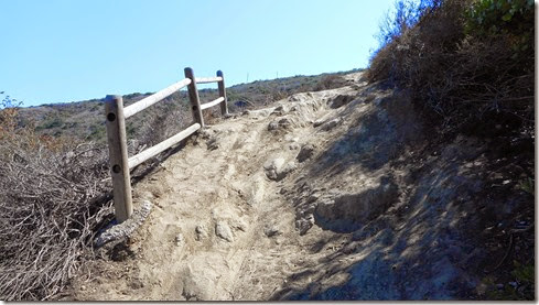
No-Name Ridge:

No-Dogs Trail:

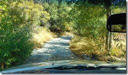
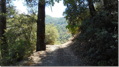
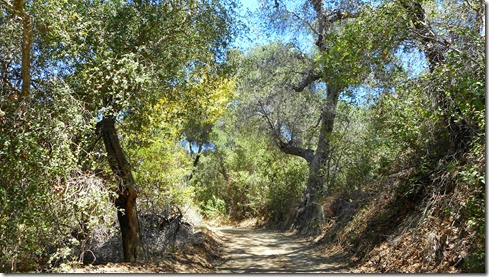
Making my way through the canyon & stopping in the first bit of shade:

Much needed shade (& this was about all of it):
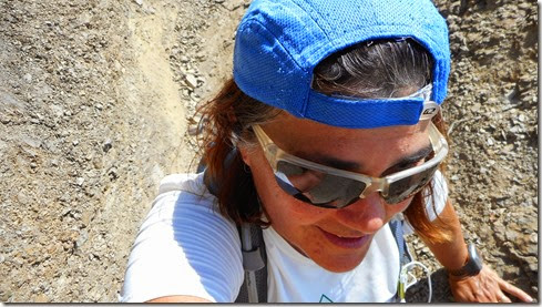
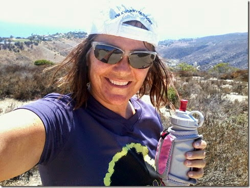
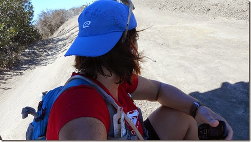
With about a quarter mile left before reaching Bommer Ridge, I konked out.  Light headed, I needed to cool off my body temperature.  It appeared that I let heat exhaustion overcome me once again.  Dang it.  Sitting in the shade, I took in a nice breeze and it seemed my temperature cooled quickly.  After about ten minutes, I finally got to my feet and slowly ran the additional 1.5 miles to the truck. 

Recuperating, waiting or my temperature to drop:
8 15 14

Oh!  And I was on the news – a Spanish language station.  A running friend, Conrado, took a picture of his television as I ran across the screen, and sent it to me via facebook. Smile with tongue out

Wednesday, August 13, 2014

Change of Scenery

Tuesday, I got out the door at noon.  Noon.  And I ran 9.43 miles around town, down to the beaches, back up to the headlands and through town back home.  It was hard running at a quicker pace for more than nine miles.  I need to do this more often.  (Fat chance Winking smile)
Monday, August 11, 2014

The Beautiful Modjeska

I shut off my early morning alarm ONCE AGAIN.  But all was no lost Sunday morning.  I threw caution into the wind and pulled my truck out of the driveway at 9:30 AM.  9:30 AM!  An hour later I was winding my way through a little town called Silverado, driving 25 miles per hour, onward to Maple Springs Road.  With the weather warming up, I feared I hadn’t packed enough fluids for an afternoon run and stopped by the only market in town for a Gatorade – just in case.  

At the trailhead, I continued on driving up a single lane road until the pavement ended.  Parking my truck beneath a tree in the woods, I headed up the dirt truck trail at approximately 10:40 AM.  The heat was sweltering, and quite frankly, I wondered how I was going to manage a mountain run.  With a cold Gatorade in hand and 72 fluid ounces on my back, I moved on as I always do – one foot in front of the other

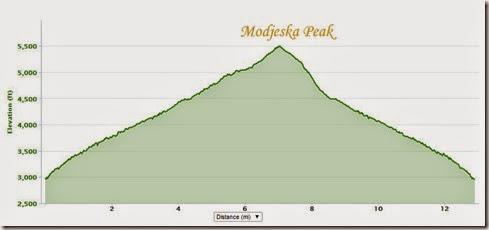
I hoped that I could run up to Modjeksa Peak because I have this thing about summiting.  Love to summit.  If the weather grew too unbearable though, I gave myself an out, with a turnaround point at “Four Corners,” which is 4.25 miles up the dirt road called Maple Springs. 

Thank God for shade.  The first leg of my mountain run went well – I arrived to “Four Corners” having finished the Gatorade but without dipping into my hydration pack.  My leg “injury” did not cause a problem either.  I did experience a slight ache though, and took two ibuprofen since I decided to venture onward to the peak. 

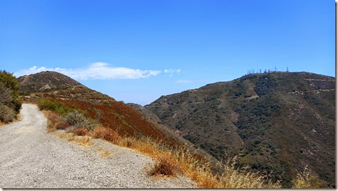
I ran straight through “Four Corners,” where three off roaders parked.  And the gnats kicked in just as I turned onto The Main Divide.  With little or no shade and gnats flying at my face, the rocky terrain proved difficult.  But who am I kidding – this portion of The Main Divide is always difficult for me.  So, it was business as usual – one foot in front of the other.

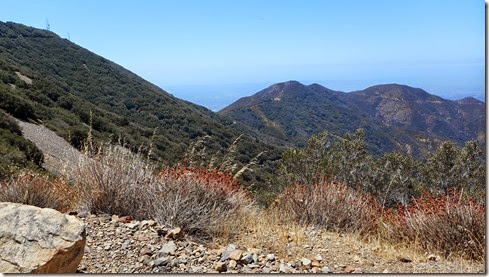
At a little over 5.5 miles travelled, I turned the bend in The Main Divide for a view of two main peaks in The Santa Ana Mountains:  Modjeska and Santiago, the far ends of the saddle.  Wow.  I still daydream about it even a whole day later.  Setting my eyes on these peaks makes everything all better, the gnats, the heat, the rocks . . .  This is an emotional spot in the mountains for me – the scene of so many victories and agonies as well.  It’s what I see back home, the backdrop for most of my coastal runs.  

I turned off The Main Divide and trudged up the sort-of-single-track to Modjeska Peak.  No more cars or motorcycles.  I had this part of the mountain all to myself – except however for biting horseflies that took tiny chunks out of my arms and legs, oh and lest I forget, swarms of gnats hovering about my face, focusing on my mouth, nose, ears and eyes. 

Heading up to Modjeska:

The final ascent:

At last!

Polish actress, the beautiful Helena Modjeska, whom this peak was named after:helena modjeska

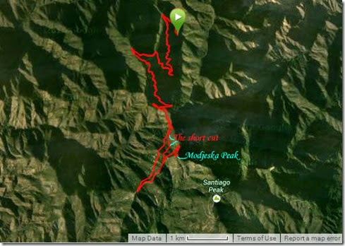
A mountain biker once told me about a short-cut coming off Modjeska Peak that takes you straight down to “Four Corners.”  I’ve looked for it, asked hikers and other bikers about the trail, to no avail.  That is until I ran The Harding Hustle last month. I  don’t recall whether it was during my first or second trip up to the peak that out of the corner of my eye I noticed a  “do-not-go-here” trail marking.  Do not go where? I thought.  There’s only one way to go.  And that’s when I saw it, a partially hidden, true-single-track disappearing down the side of the mountain. 

This Sunday, I sought out that trail on the way down from Modjeska.  The trail seemed so obvious now.  Still, I felt a little nervous.  Bike tracks relieved me some.  If a mountain bike could take the trail, then I could take it.  Hopefully.  A lot of short cuts are short because they take you down the face of a cliff or something ridiculous like that.  Determined to focus, I shut off my music.  But I kept the ear buds tucked into my ears else the growing number of gnats drill through to my brain.  I could hear them crashing up against the buds, desperate it seemed to hit gray matter. 

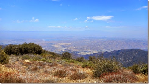
The trail was steep, so steep that in some points the ground merely slid beneath me as I attempted to run the terrain.  It’s been a long time since I’ve ventured onto new ground.  The views were immeasurable.  The trails were shady.  They were rocky.  And they were swarming with gnats.  Fortunately, my short cut didn’t take me down a cliff.   But because I ran an unbeaten path, I was extra careful not to fall.  My cautious gait was so slow, I wasn’t sure if this was going to be a “short cut” after all.  But soon, very soon, I caught “Four Corners” in my sight, and it seemed as if I had cut a mile and a half or so off my trip.

The “short-cut”:

Sure enough, this trail dumped me off right at “Four Corners,” on a portion of single track so steep, I sat and slid down it.  Oh ya!  Only 4.25 miles to go:

8 10 148 10 14 2

Saturday, August 9, 2014

Wide Angle

I got off late on Friday, about 2 PM (surprise, surprise) for my pretty regular ten mile loop in Aliso/Wood Canyons.  I was armed with a new camera.  (My product warranty check came in – yay!  These product warranties on my cameras are the deal of the century for me.)  My new camera has a wide angle lens, which is new for me.  My husband’s professional camera has a wide-angle lens that I’ve never been too impressed with, 1) because it’s too dang bulky, and 2) it casts a shadow when the flash is used that I didn’t care to learn how to deal with.  But my new camera is one of those little things with the lens built in, and I hardly ever use a flash (& even if I did, I’m not getting a shadow with this camera). 

About a mile and a half into this run, after the back of my thigh began to ache, I switched on the wide angle for some shots of trails I have run countless times.   I was surprised what a different view this camera gives  – a more realistic view, one that captures not only what’s in front of me, but also what seems to surround me.  Very happy with my new purchase. 

The ache on the back of my thigh, right around the upper knee, grew worse as I made my way toward Mentally Sensitive.  I considered cutting the loop about a mile short by running up Meadows Trail instead.  Meadows is a steep switch-back to the ridge.  Mentally Sensitive is steeper, and not much of a switch-back at all.  I opted for Mentally Sensitive, because I’m just that way sometimes – a glutton for punishment.

I found the climb up Mentally Sensitive excruciating, but not surprisingly.  Fortunately, I had my new wide angle lens camera to keep my mind off the growing pain in my leg. 

By the time I reached the top of Mentally Sensitive, my leg was no longer an ache – it  hurt.  I could still run along the ridge, and I did.  By the time I made it to Meadows, I decided it was time to cut this ten mile loop down to seven miles.  I headed down the steep Meadows’ switch-back suffering.  It’s a mystery to me how I injured my leg.  There was no event, no popping, nothing to indicate an injury.  My guess is that I strained it the day before in the gym.  That’s what I’m hoping anyway, as I think that I can recover from that pretty quickly.

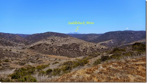
The Top of Mentally Sensitive/Saddleback Mountains in the background:

By the time I reached the bottom of Meadows, I could no longer run.  I couldn’t much walk either.  The pain remained the same whether I ran or walked.  That last mile and a half, I mostly walked, but ran some because I wanted to finish this up to stop the pain.  Finally back at the truck, I wept.  I didn’t cry because of the pain though – I was just so dang angry about having an injury.  I am such a baby when it comes to mentally enduring injuries.  Sad smile  Maybe that’s what they mean by “Mentally Sensitive.”

8 9 14

Wednesday, August 6, 2014

Smack-In-The-Middle-Of-The-Afternoon Trail Miles

140806_004Still have not managed to get up at the crack of dawn – summer is turning me into a sleepy head. Sad smile  I did manage to get in  some smack-in-the-middle-of-the-afternoon trail miles today however.  Yes, the weather was extremely hot.  But I’m getting used to that. Smile I quickly exited the canyon (Wood Canyon, which tends to trap in heat for a furnace-like run) and headed for the ridge.  This decision proved to be the best choice with occasional ocean breezes blowing my way.  And go figure, I didn’t see one other runner out there on the trails this afternoon. 

A View from Top of the World:140806_008140806_009

8 6 14