TALES FROM THE TRAIL (AND SOMETIMES THE ROAD TOO)

Thursday, September 4, 2014

Wood Canyon

My three sons went back to school today.  This made me sad.  They don’t get seemingly endless summer vacations like I did when I was a child.  I used to grow so bored during summer vacation that I was begging to get back to school.  This is not so for my sons.  Summer breaks have shortened by at least a month.  Though we are ready for them to return to school (believe me, VERY ready), they are not.  And I already miss them. Sad smile 

So, I took my sadness on this overcast day and ran through a lonely Wood Canyon – 7.07 miles, and as usual, was better for it.  Not much to report except for these tranquil scenes:

Tuesday, September 2, 2014

Road Training

Waiting patiently for the season to change. Smile with tongue out Waiting patiently for something to give, for some kind of routine . . . until then, I’ll get my runs in when I can, dare I write it, WHERE I can.  Yes, today, I saved on gasoline and time, and ran out the front door for a quick road run totaling 5.6 miles.  

Running above traffic to the beaches:

I warmed up quickly with my usual late start.  And quite different from my usual trail runs, I was in the company of lots of other runners.  As I am getting ready for school to start, as well as, interviewing for jobs, I may be hitting the road a few more times as I head up toward the Spartan Beast where I am sure to die an epic death (figuratively speaking).

Hoping to hit the trails soon.  Until then, I think I can take these beach scenes for a little bit longer. 

If you are moved to donate to The Semper Fi Fund, you can do so using this link for my Support Through Sport page. Smile

Sunday, August 31, 2014

One More Run For August

Saturday, I had planned . . . oh heck, forget what I planned.  This is what I did.  I set out at 2:30 in the afternoon for a ridge run in the coastal hills.  I didn’t begin on the ridge; I began in Wood Canon and made a quick, steep climb to the ridge.  It was HOT, like the devil.  But it was beautiful and oddly refreshing.  I didn’t see a single other runner out there, or hiker for that matter.  But I did see plenty of mountain bikers – a friendly bunch.   

I ran along the ridge, with ocean views, to Top of the World in Laguna Beach.  Total run: 6.5+ miles with a nice, semi-mellow climb.

8 30 14

ps.  Happy birthday Jeremy!  Wishing you the best on your Disney runs. Smile

Saturday, August 30, 2014

But it’s Flat

Well, August has not been a total bust, but near so!  My excuse:  the heat.  Yes, this summer has not been nearly has hot as the previous three summers.  Still, I have not enjoyed running in the heat this year.  Not one bit.  Though my miles are much under goal, my cross-training is not terrible (the gym is air-conditioned).  Despite the heat, I did manage to get out on Arroyo Trabuco trail yesterday, at ten o’clock in the morning. Smile with tongue out  As I headed out the door, my hubby responded that I was choosing the hottest trail, to which I responded, “But it’s flat.”  To the trail runner, Arroyo Trabuco is flat.  To me it is flat.  When I was a road runner running mostly flat streets however, I would have never considered Arroyo Trabuco “flat.”  Here is an elevation profile of yesterday’s “flat” run:

8 29 14

This out-and-back, which begins on Antonio Parkway with access down to Tijeras Creek trail, travels Arroyo Trabuco for six miles, ending at the trailhead in O’Neill Park.   This trip is clearly suburban trail running, with plenty of homes overlooking the trail, giant overpasses to run beneath, and occasional views of trucks and cars from the roads above.  Much of the trail however, is covered with thick vegetation, blocking suburbia from view.  It really feels like I’m out in remote wilderness much of the time (aside from the automobile noise). 

I divide this 12 mile run into three legs (three times two, as it is an out-and-back).  There’s the “lowlands” (shady and lush), the “highlands” (hot and exposed) and then “lowlands” again (both hot/exposed and shady/lush).  My favorite portion is the first “lowlands.”  It is the coolest.

The “lowlands” #1:  Begins on Tijeras Creek Trail which crosses a small creek and runs up into Arroyo Trabuco:

What I call “The Jungle,” because my friend Tom Fangrow called it that:

I do not really look forward to leg#2, the “highlands.”  On a winter day however, it would be just fine (much cooler!). 

Entering “the highlands” on this “flat” trail: 

Some history on this portion:

Trying to figure out how to strike a pose:

I felt great relief reaching “lowlands” #2.  Views of The Saddleback Mountains came into view and shade lay in places ahead.  To top it off, water fountains and restrooms awaited me in the neatly manicured O’Neill park. 

Entering leg #3, the second “lowlands”:

Turnaround point in O’Neill Park, time to turn around and run back, but not before watering down:

Sunday, August 24, 2014

Yaeger Mesa

During the late 1800’s a man named Jake Yaeger had a cabin along Trabuco Creek and mined a mesa he owned up the canyon.  His mining efforts (which ran between 1899 and 1925) proved unsuccessful, but his name still lives on with the mesa taking his name:  Yaeger Mesa. 

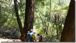
I have only visited Yaeger twice before.  It’s not an easy task, and one that should not be taken alone.  It’s steep, it’s lonely, it’s long, and it’s hot.  But it’s beautiful.  I took that trip for a 3rd time yesterday, Saturday August 23.  First however, I hiked up Trabuco Canyon with my son on Friday, the day prior, to stash water at what would end up about mile 8.5 in my Yaeger Mesa loop.

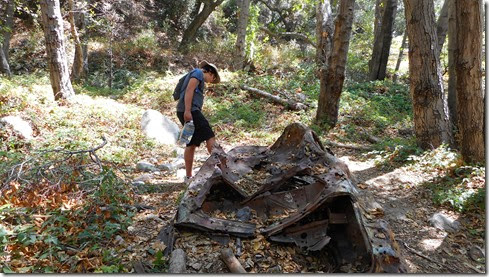
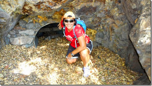
On the way we stopped of at an old shot-up car, and also posed at the base of a closed-off mine-shaft:

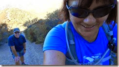
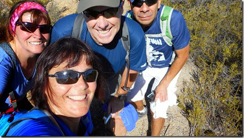
Saturday, I managed to get myself out of bed at 4:45 AM.  I woke to the noise of Hank’s text arriving to my phone.  He was on his way.  Fortunately, I only live about thirty minutes from the trailhead, so I was able to take in a cup of coffee and casually change into hiking clothes.  At 6AM, I met my friends Hank, Judi and Matt, and we headed up the steep county trail called Bell View.  Did I mention that it was steep?  Well, it was.  And this was only the beginning. 

Looking back on The OC:

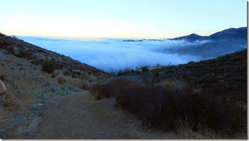
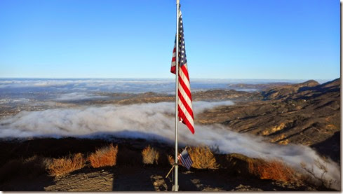
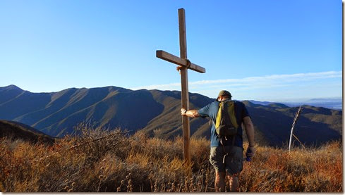
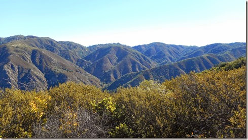
After about a mile on Bell View, we got off the beaten path and took an unmarked single-track referred to as Bell Ridge.  The climbs were immense, but we had relief with the occasional downhills and flats.  I felt confident that we were headed in the right direction when we spotted the flag.    Soon after, we came upon a giant cross that I hadn’t see before.  We bushwhacked out to it for quiet awesome views of the county. 

And then we continued to climb, and then climb some more.  And when we climbed a hill that seemed so steep that we couldn’t possibly climb one steeper, we’d come up on an even steeper hill.  Often I used my hands and arms to hoist me up particular difficult sections.  The steepness was laughable. 

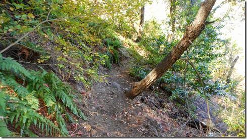
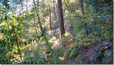
At about mile six, Bell Ridge turned abruptly to the left, and we headed downhill before one last uphill to the peak.  At the top of that next hill, at about mile 6.5, we took a turn onto another single track and headed down a ridiculously steep loose-dirt trail.  It was shady.  It was lush.  And it took all my strength just to stay up right.  Often I leaned into my hip and slid down, but was careful to periodically change hip sides to avoid injury.  At one point, when simply just standing, my feet flew out beneath me and I crashed to the ground.  With minor cuts to my right arm, I worried more about the status of my camera, which I distinctly heard slam against a rock on impact.  Fortunately, all was well with my trusty camera.  I would find out later that evening however, that all was not well with me from that fall.  (I experienced pretty severe back pain for several hours before finally taking ibuprofen to ease it some)

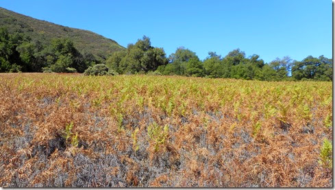
Around mile 7, we finally reached Yaeger Mesa which is a large field filled with bracken fern year-round.  On Saturday, the ferns were a yellowish-green which from afar (say from The Main Divide or Horsethief) looks bright green.  Other times of the year the ferns are brown, green or even red (see prior winter visit by clicking here).   There is nothing like it in Trabuco Canyon, or anywhere that I’ve been in the Santa Ana Mountains.  Yaeger Mesa is one of my happy places. Smile

8 23 14a8 23 14

Friday, August 22, 2014

Catching Up

With life getting increasingly busy lately, I have fallen behind recording my runs.  So, in an effort to quickly catch up, here’s a picture recap of my last run (Wednesday of this week):

8 20 14a8 20 14