My diet:
Sunday, December 16, 2018
Chiquita Again
My diet:
Sunday, November 4, 2018
Clearing Chiquita
Monday, February 18, 2013
More Practice ( and, What was I thinking??????)
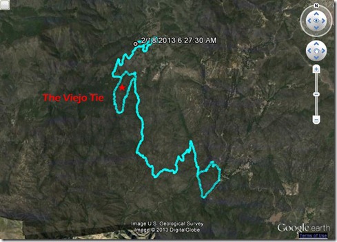
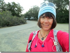 I hit the Saddleback Mountains today, driving up before sunrise. My plan: run the correct Old Goat first 20 miles. I had previously missed a turn onto what’s called the Viejo Tie. And I was also ending this partial practice course on “Old” San Juan Trail instead of “New” San Juan Trail. The Viejo Tie and the correct ending added about 2 miles to my usual route.
The campsites were full, but quiet as I ran the paved road toward San Juan Trail. I believe I was the first runner or cyclist to show in Blue Jay. Not a person stirred. The weather was cold as I focused on pace, running San Juan Trail without music at first. It’s an extremely rocky trail, my biggest fear was falling. In fact, San Juan Trail is the location of one of my biggest trail running falls ever. Still, I was happy that I made it to the Viejo Tie in good time.
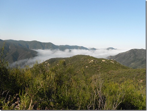
Running above the clouds on San Juan Trail: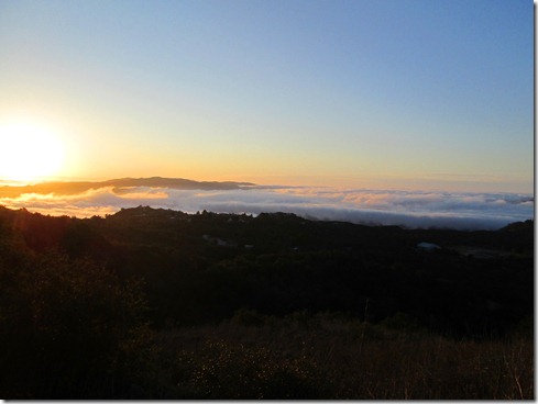
The Viejo Tie added more technical trail (by-passing a milder portion of Chiquita). So in-tuned and focused, I surprisingly caught the quick left turn I was supposed to take according to the map I closely studied last night. I ran uphill, then downhill, then uphill, then downhill, again and again, until I worried that I took a wrong turn. And then FINALLY, I saw it – the Viejo Tie/Chiquita Trail intersection. At this point, I was still pleased with my time. Not exhilarated, merely pleased.
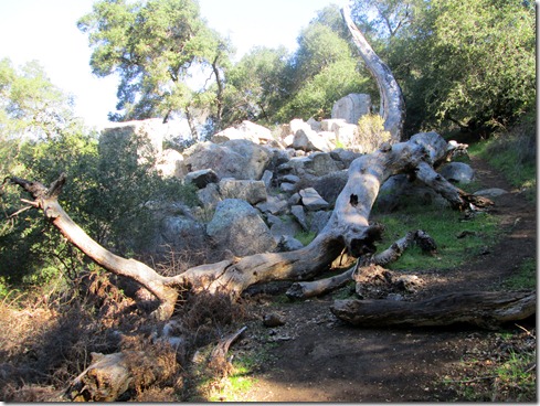
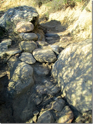
These twenty miles are extremely difficult for me to run. Some parts are quite technical, at times with boulders blocking the way. There’s tree roots and tree stumps crossing the trails. There’s slippery sandy parts. There’s ruts and crevices. Thankfully, there’s also lots of shade.
I made Chiquita falls a little disappointed by my time. But I told myself, “Don’t fret, don’t grow anxious, IT IS WHAT IT IS.” I had finally controlled my anger over tripping on rocks. I kinda figured it wasn’t good for the mental game if I yelled out a profanity every time I tripped on a rock.
Running the San Juan Loop into the parking lot: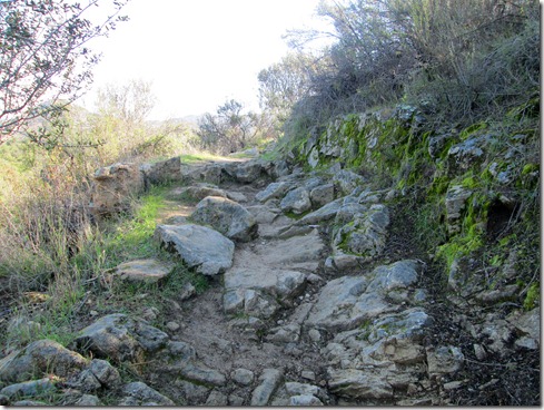
I arrived to the turnaround point across from The Candy Store 50 minutes past my best case scenario, 20 minutes past the deadline for making the entire route within the first cutoff back at Blue Jay campground. To make matters worse, after digging my water jug out of the bushes and refilling, I accidently dumped my entire re-fill. So, I made it back to the bushes for the jug, refilled the bladder again, dissolved Nuun tablets again, squeezed the air bubbles out again. I spent 8 minutes at the turnaround. I didn’t give up the idea of at least trying to make the cut-off, and kicked it in for the most difficult part of the trip. I ran most of the time, hiked the steepest portions.
I grew so fatigued toward the end of my climb back, I decided that when I hit the cut-off time, I was going to cut the course and head back to my truck.
And then, my ipod battery died. That’s when I heard the breeze. It sounded like beautiful music to my ears. The tree leaves rustled in the wind. And leaves crumpled beneath the squirrels’ tiny feet as they scampered back and forth across the trails. I didn’t want to leave the trail. So, I decided to run the whole first part of Old Goat and not cut the course.
In the end I came in 18 minutes past the cut-off. I’m okay with that. I’ve got a little time. Besides, today was the first time I ran the Viejo Tie. Not only that, I felt good when I finished, like I could run another thirty miles.
(Still, what was I thinking?????).
Saturday, January 19, 2013
The Candy Store Run
In preparation for Old Goat 50 this March, I left early this morning for a drive up the mountain to run what we call “The Candy Store Run.” It’s named this because either the beginning, or the middle of the route, is across the highway from The Candy Store up Ortega Highway in the Cleveland National Forest. This route is approximately the first twenty miles of Old Goat. It’s single track, it’s technical, and even the downhill is hard, very hard.
Since I parked across from The Candy Store I ran approximately miles 10 through 20 first, then turned around and ran miles 1 through 10 of Old Goat. To run the route correctly would have meant driving several more miles and parking near a Big Baz trail race event today. I was in the mood for some solo running this morning. And solo running I got for a long, long time.
I found the “hard” part (mainly uphill) quite pleasant this morning. The air was still cold and the scenery was breathtaking. I felt strong the entire way into Lower Blue Jay campground.
Running San Juan Loop down into canyon: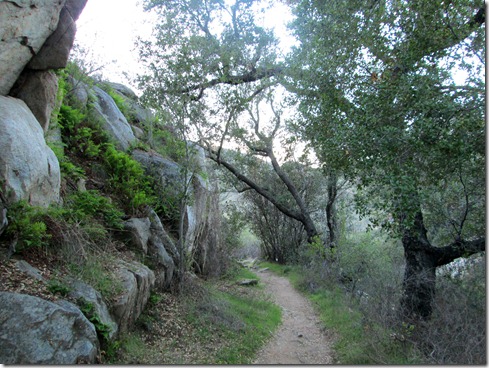
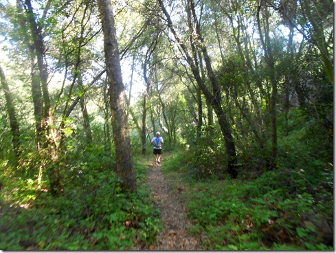
Chiquita Trail:
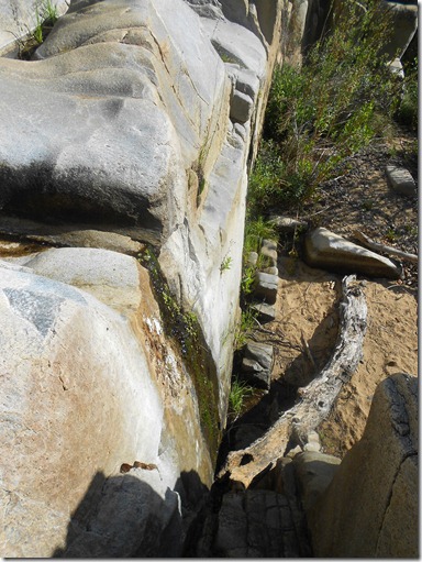
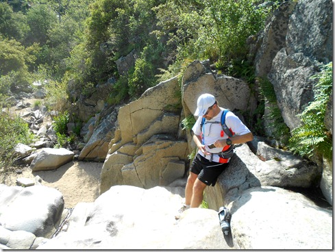
A stop at Chiquita Falls (which was dry). I spent some minutes here, which won’t happen in the race. (However, I must get in and out of the aid stations quickly come March!):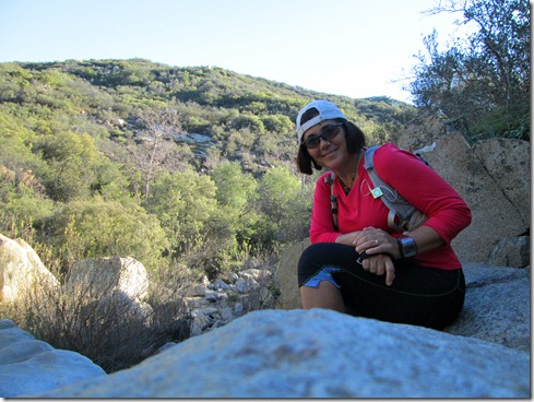
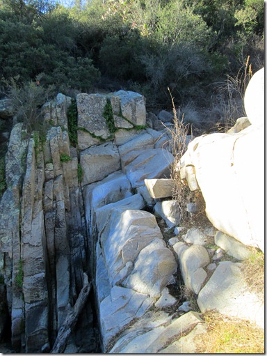
I entered Blue Jay Campground toward the end of Baz’s race. I ran the opposite way as several worn-out runners. Some were bloody and bruised (and bandaged), one lady was even holding her wrist up as if it was sprained or broken. I also saw a running friend, John H. in the campground after he finished up a solo 20 miler. Even though I didn’t stop by the Start/Finish, I could hear Baz’s voice booming through the mountains. Sounded like a fun time. Though the race was only a 12k, I could have benefited from it for speed training. But I really needed to do this Candy Store Run. I wanted to make sure that I could make it with enough time to complete the remaining 30 miles.
Turns out I ran this extremely difficult terrain in 6 hours, the absolutely longest I can take and maybe finish the 50 miler. I did stop at the falls. I also talked with John a bit. Then on the final stretch back in I was stopped by nearly every group of hikers coming in (at least 4 different groups). Now, I feel an obligation to be kind to strangers, and an even stronger obligation to answer their questions when they don’t know where they are, and I do. I would HATE IT if I brushed off a hiker and he/she ended up lost.
One young woman hiking with her boyfriend asked me with despair in her voice, “How much longer til the end?” There’s that question again. Exactly WHERE IS THE END? (Giggle, giggle).
I stopped. “Where are you going?”
“Chiquita Falls.”
I couldn’t do the math quick enough using my garmin, and I really wanted to get going. So, I asked, “How far have you travelled?”
“About an hour,” the woman responded.
(Hardy laugh inside my head, but a wide smile on my face) Time on the trails gives me absolutely no information. When I talk about driving, I always talk in time. For example, “It’s an hour drive.” But not when it comes to running trails.
“I mean, how many miles?”
Her boyfriend told me that they had gone about 2 1/2 miles to which I responded, “Well then, you are half way there!” He smiled at his girlfriend and gave her a reassuring hug.
With about a mile remaining, and out of water for a while, three guys stopped me and asked, “Is there a peak or something somewhere around here?”
I grinned, almost laughing looking up at all the peaks in the mountains. Then (with a giggle to myself), I said, “Santiago Peak is about 30 miles away.” I could tell they wanted to hike to a place of interest. So, I told them about Chiquita Falls and how to get there. Then as they marched off I noticed that each of them held ONE water bottle about half full. “You don’t have enough water!” I yelled back. I pointed to the ridge they’d have to go over and noted that it was exposed. They’d never make it. Good thing they believed me. When I told them about the much shorter loop back to the parking lot, they said that sounded better.
We’re in the 80’s F here now in California. When I arrived to my truck I was parched! Without water for a mile or two, I couldn’t wait to get to the coconut waters in much truck that I had frozen the night before. I felt for sure they’d be warm by then. Turned out they were still frozen solid. Desperate, I ran across the street to The Candy Store. It smelled sickly sweet of freshly baked cookies and muffins. I grabbed a water and a diet coke, swiped my debit card, and the total came to $4.85!!!! Now if you have read my blog on occasion, you may have deduced if I haven’t already downright written it, I AM POOR. There’s no way I’d ever pay that much for those two drinks (24 packs of cokes or water cost around $6 to $7). Then the friendly cashier said that debit cards had a FIVE DOLLAR minimum. “Would you like to add a cookie?” The thought of a cookie made me want to vomit. So, I added a small bag of candies for my sons’ dessert tonight and my total came to over $7. Moral of the story – FILL UP ON WATER WHEN I GET TO BLUE JAY CAMPGROUND. I had the chance, but I didn’t. To make my mistake more stupid, I ran out of water after not re-filling at Blue Jay the last time I ran The Candy Store Run.
Despite the water thing, I loved this run. BUT, I really must do it faster. Like an hour faster!!! I want some time to spare for the next 30 miles.
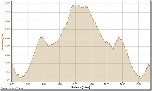
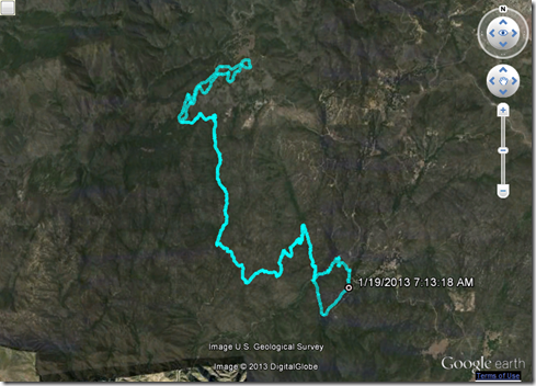
Today’s profile ![]() :
:
Sunday, May 6, 2012
Candy Store Run
My last run was last Sunday. I recovered Monday. Then my mood dipped pretty low. I felt I needed to get my disordered life in order, so I spent much of my time organizing and cleaning and applying for more job positions. Hubby begged, “Please, go out and run!!!” He didn’t say that because he wanted me out of the house. The house was much cleaner after all – carpets vacuumed, floors swept, bills organized. He just knows me. He knows that runs would have lifted my spirits. But it was gray and wet all week. And that just made me more depressed.
In the interim, I did work on physical strength. I did weight lifting, core work and general strength exercises nearly every day. Then Saturday, I ran with my two youngest sons in the Kids Run The O.C. program. I wore my New Balance Minimus trail shoes, which I can’t wear on the trail at all – they just aren’t substantial enough for technical terrain. Anyway, even though the kids run was only one mile, I felt really good getting my legs moving. The shoes were awesome, extremely comfy on the pavement. It was all over too soon, and I couldn’t wait for today’s scheduled group run.
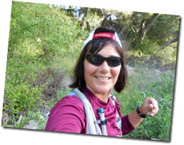 As many as 8 runners may have shown at 6:30 AM up in the local mountains. Turns out, just two showed – me and my running friend, Michael P.
We started off on “The Candy Store” run on a cool morning, across the street from the candy store on Ortega Highway. Right away I took us on a wrong turn, and we had to run back to the trail to continue onward. Then once we got going on the correct, lush shady trail, I noticed that we were making a loop back to the parking lot. I missed the turn off to Chiquita Trail!! Missing the turn off added at least a quarter mile of technical uphill running (& back totaling 1/2 mile).
Back on track, running Chiquita Trail: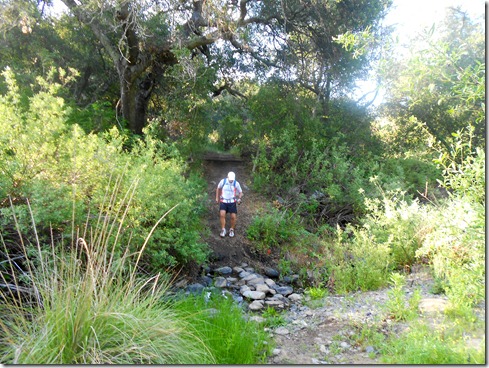
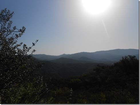
I found the trip up Chiquita delightful and wondered why it tore me apart so badly during the SJT 50k. Of course, I had about twenty miles on my legs before making that trip!
The trail was empty on the out portion today. We saw one hiker with hiking sticks making his way down. He said this was, “The one trail that’s uphill on the way out and the way back.” Seems so true. But in reality it’s not. Michael said that it’s like an Escher drawing.
This time around, I was sure to search out Chiquita Falls, which I have failed to discover on my prior out-and-backs on this trail. I found much less than I expected. The falls were dry.
And then we ran more Chiquita trail, now mostly in the shade. It was lovely, lush and green. And most of that green in the undergrowth? POISON OAK. I brushed against it again and again. Here’s to hoping my apparent immunity to the plant is still intact.
Arriving to the Chiquita trailhead, we had a choice to make. 1) Turnaround and run back, or 2) run a loop up San Juan Trail into Blue Jay Campground and back to Chiquita for the return trip. We chose more mileage. But first, Michael was attacked by fire ants as we tried to set up our cameras for “group” photos. Ouch!
San Juan Trail, all ridiculously uphill and seemingly never ending was hot as well. Mountain bikers made their way down the single track as I focused on not tripping over the rocky terrain. At each turn I thought we were at the trailhead, only to find – No! There was more to run in this heat. Finally, we could see campgrounds and we simply ran right through the hillside into the campground, cutting off approximately a half mile from this run.
Blue Jay Campground seemed like a a 5 Star hotel to me. A cool breeze blew. There were trash cans to empty my pockets. There were outhouses. There were people. And there was even running water.
Well, the “down hill” trip back was not all down hill. And when it was downhill, it was usually rocky and difficult to traverse. On our way back to Chiquita, we came to the 4-way fork that I asked Michael to mark on our way in, because I lose my sense of direction there and have twice taken a wrong turn in the past. Sure enough, I had no sense of direction when we arrived to the markers. Had Michael not marked it, I would have surely chosen a wrong turn. Funny. Even with the markers, I began to run down the wrong trail!!
It was hot and I was growing extremely tired. I wasn’t the only one. Two mountain bikers (male & female) were sitting in the shade on the rocky trail, looking utterly fatigued. They complained that they were “so hot,” and asked were they could find water. They each had two bottles of water – one of them empty, the other with some water remaining. When Michael pointed out the quickest way into Blue Jay, they took one look at that giant hill we had just run down and said, “No way, we’re not going up there for water.”
It’s good the two were sitting in shade. But they still had the trip to make back to the candy store. I urged them to make the hike into Blue Jay. “Just leave your bikes here,” I suggested. They didn’t look like they’d be able to make the 8 plus miles back to the parking lot with the little water they had. I hope the two rested a good long while and took our advice and hiked into Blue Jay. We didn’t come across them again.
And we were off on the long, long HOT trip “down” Chiquita Trail with Michael taking the lead. After a few miles, I suddenly came upon Michael standing on the single-track facing two hikers. “We’ve got a rattler here,”’ he said. I could hear its rattles from several feet away. “Do you think I can get a picture?” I asked and everyone laughed. Turns out, I couldn’t get a picture. And I was a little bummed about that.
I really don’t fear rattlesnakes. That’s not to say I don’t fear being stricken by one. The best thing that can happen with a rattler is that you see it from a safe distance. And we were at a safe distance. As I moved in closer to see it coiled up in the brush, the two hikers nervously backed away. I asked Michael if he could tell how big it was. He said he thought it was about four feet long. Well, I gave it an extra couple feet just in case, which means it’s striking distance would be about 3 feet or a little more. The trail was about three feet wide, so I hiked up onto the bank on the opposite side of the trail as the frightened snake rattled away. Now, not only would the rattlesnake have to strike more than three feet – he would have to strike me up hill! (They can supposedly strike further down hill). The two hikers looked at me like I was absolutely crazy. Michael followed right behind me to pass the danger. When I told the hikers that a rattler can only strike a little more than half it’s size, they too hiked up on the bank. They looked back at us nervously. “Just give them their space and you’ll be fine.”
And then Michael and I continued to run – run in the heat and on the rocky, miserable terrain. I was so dang tired, it would have felt good to walk the entire remaining miles, but with about three miles remaining, I wanted to get back ASAP. My fluids were gone.
The “down hill” back to The Candy Store: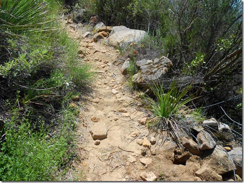
The last three miles were excruciatingly difficult. We hiked some, we trotted some, we ran some. Michael got out ahead often, but I could see him stop and look back. It really was wonderfully miserable. And when I thought I could no longer take it, I looked around me to take in the beauty. I dreamt of the ice-cold Gatorade in my truck. And I refused to look at my garmin.. I also concentrated breathing through the nose, which worked very well since I ran so slowly. It also helped to calm me down. I tend to get a little anxious when the run gets super tough.
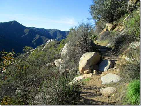
The Beauty that surrounded us: 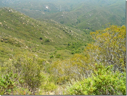
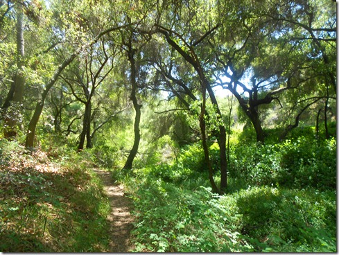
The last mile was truly hellish for me. No fluids and extreme heat, not to mention uphill terrain, was not a good mix. But as Michael said, “One foot in front of the other, eventually we’ll make it.” I think he was a little worried about my directions, especially since it TOOK SO LONG to catch even a glimpse of the parking lot.
What a beautiful sight it was to see signs of the parking lot. I actually hollared, “Woo-Whoo!” when my feet hit that pavement.
Elevation Profile (19.11 miles):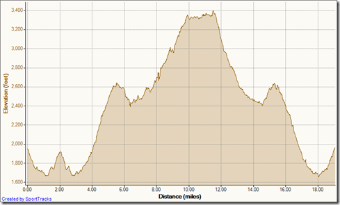
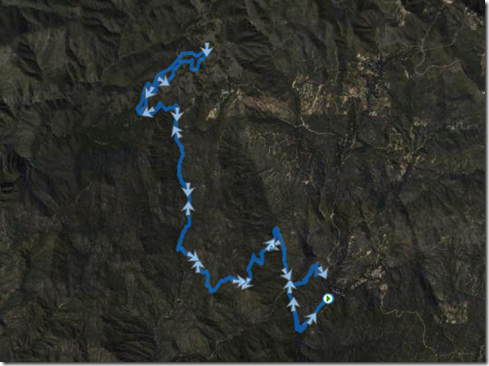
And of course, the satellite (notice the wrong turn in the beginning, where the loop almost closes – LOL):