TALES FROM THE TRAIL (AND SOMETIMES THE ROAD TOO)

Showing posts with label Mathis Trail. Show all posts

Tuesday, December 18, 2018

Bye-Bye Garmin

So . . . recently, I went for a hike-run in Wood Canyon, but I can’t tell you for sure what day it was (I believe it was last Wednesday 12/12). I also can’t tell you any other stat, like distance or elevation gain. Why? Because I lost my Garmin on the trail. And sadly, that Garmin had to go. My relationship with that thing was definitely a love-hate relationship. I loved the stats it gave me, and the interface was pretty good. But really, what a pain in the ass it was to charge (very difficult to make the connection), and I can’t tell you how many times I could not upload my info. I had to constantly reset the thing, and then to top it off, the wristband broke, and the stupid thing does not accommodate a replacement band. I was bound to eventually lose my Garmin carrying in my pocket as I did. I suppose the reason I lost my Garmin is because I went crawling around in caves again. I’m pretty sure that’s when it dropped out of my pocket.

So, I set out late morning, Garmin in hand for what I am going to estimate as an 8 mile route. And because of my mood, which was somewhat down, I decided to make my loop include one of the biggest inclines in the park -- steep inclines do wonders for my mood. My route: Aliso Canyon, Wood Canyon, Mathis, Oak Grove, Car Wreck Trail (super steep!), Mathis, Wood Canyon, and finally back to Aliso Canyon. I noticed my Garmin lost in Wood Canyon on the way back, and did not have any time to go back and hunt for it. I had to get back home in time to attend my middle son’s Christmas concert. And frankly, I really didn’t even want to look for it. I am done with Garmin!

Some observations from my hike-run:

First off, I saw 7 (yes seven!) deer grazing in Aliso Canyon. I have seen many deer in those canyons, but never as many as 7 all at once. They didn’t even flinch as I stood there across the field snapping photos of the bunch. They did look up at me here and there, which is much more to than humans on the trail did. Which brings me to my second observation. People in the coastal hills do not look at you when you come up on them on the trails. Nothing, not a word, not a nod, not even a smile. I find that strange. I try to make eye contact with everyone -- and then I nod or smile. This lack of acknowledgement by other hikers and runners would never happen on a mountain trail. When you come up on someone in the mountains, you are bound to stop and chat a bit with them.

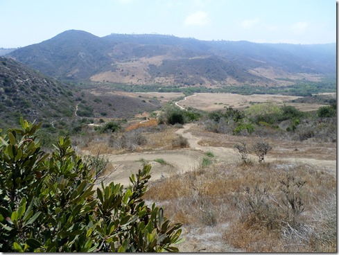
IMG_5585Despite losing my Garmin, this hike helped immensely with dealing with my stress. The creeks were full and even rushing over their usual borders in some places.  Green grass was popping up everywhere, including in the black burnt areas. I loved the torture of Car Wreck Trail, and amazingly, it really wasn’t that much torture at all. It was a good thing climbing up that trail, just as it was a good thing that I lost my Garmin.IMG_5586IMG_5605IMG_5627IMG_5634IMG_5639IMG_5641IMG_5658IMG_5662IMG_5670IMG_5671

Thursday, March 22, 2018

Five Weeks on a Ketogenic Diet

I changed my way of eating five weeks ago, and I have dropped 15 pounds. So much more important than those 15 pounds are some other wonderful side effects I have experienced since changing my way of eating.

Before the diet change, I was dragging, most often tired, and napped every chance I got. I found it difficult to focus, and would frequently forget things (felt like a “brain fog”). Before changing my diet, I struggled to wake in the morning, and I was always hungry. Now, I have energy. I am focused. I get things done. And I am rarely tired (except when I’m supposed to be, like after a long day), which means I never nap. Amazingly, I wake in the morning refreshed, with no groggy time. And I am absolutely never hungry. I am calmer. I am more accepting. I have more patience.

All this from changing my diet? Yes indeed. This is 100% true, and it took me way too long to realize that such a change could impact my life so drastically. Who would have thought? Not me.

So, what is my new way of eating? It is called a ketogenic diet, which is a very low carb diet with adequate protein and high fat. I know to some this may sound absurd, but my calorie intake is basically: 5% carbs, 20% protein, and 75% fat. In a nutshell, I stay at or under 20 grams of carbs a day. If you are a label reader, you’ll know that 20 grams of carbs adds up very quickly. A piece of whole wheat bread for example could be 17 carbs, an apple, I believe is around 10. Good thing I have never been a big fruit eater. I should add that restricting my carbs doesn’t matter one bit to me right now because I am never, and I stress “never” hungry.

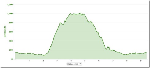
IMG_1171With all that said, I got out for another trail run/hike before the rains came down. The day was Tuesday, and my legs were still sore from Sunday’s adventure. It was a tough loop in Aliso/Woods Canyons -- up Mathis Trail, down Meadows. Fortunately, I recovered very quickly after a long difficult trek up Mathis. Recovery time has decreased a great deal as well since beginning a ketogenic diet. I am finally really enjoying the trails once again (hallelujah!). Looking forward to getting back out there after the rain dry up.

Miles: 9.37, Elevation gain: 1,181.

Feeling optimistic. And so are the plants in Southern California. Look at all the green popping through:

View from Aliso Cyn Trail:IMG_1173

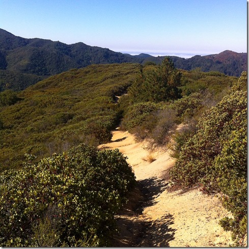
Climbing Mathis Trail:

IMG_1189IMG_1196

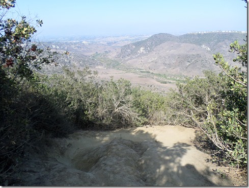
View from Mathis Trail into Wood Canyon:IMG_1197Approaching Meadows Trail:IMG_1212Top of Meadows Trail:IMG_1213IMG_12153 20 18a3 20 18

Wednesday, February 17, 2016

Starting at the Top

Generally, I prefer trail routes that get the uphill over with toward the beginning of the run. I despise having to climb out to get home. But I also hate making the same old drive over and over again. I think I hate that more than climbing out at the end. So, this past Saturday, I decided to drive along the coast and drive to Alta Laguna Park, which is near the Top of the World neighborhood in Laguna Beach. Most often I begin my coastal hill running in the Canyons, Wood or Aliso Canyon, so it’s down hill back to the truck.

Starting off with 180 degree ocean views, Saturday I began my run on a down hill – a quick down hill, totaling just around two miles (down West Ridge and then down Mathis into Wood Canyon). From then on, it was uphill, a gradual uphill, which is why I chose this route. I thought that climbing out wouldn’t be so bad if the climb was gradual. And, so for the next FIVE miles I ran uphill, on an unusually warm weekend in February. It was tough. But, I hear that I am tough, so I guess it was okay.

Winking smile

2 13 16SAMSUNG CAMERA PICTURESSAMSUNG CAMERA PICTURES

2 13 16a

Route: Top of the World, West Ridge, Mathis Trail, Wood Canyon, Cholla Trail, West Ridge to Top of the World

Tuesday, September 8, 2015

Catching Up

Running has nearly come to a halt, a screeching halt.  Though I still have a couple trips out there that have not been blogged. The foot is better, but not at all healed.  I am fine to put in around five to seven miles, but afterward, I am limping about for the rest of the day and into the next.  It is what it is, and I am learning to live with the disappointment.   

First, to catch up with the end of August:

The 20th, I believe it was, I drove my truck with my friend Emmett to the Trabuco Trail head.  We left super early in the morning to avoid the heat, and we made a trek up Trabuco Trail and then the dreaded West Horsethief to the Main Divide for an out-and-back totaling about seven miles. The trip up Horsethief wasn’t so bad mainly because I had mentally prepared myself for pure hell.  When I expect hell, it’s never as bad.  Emmett made it up to the top well before me.  Then he gave me a five minute head start for the trip down, which was down right treacherous.  Fist sized rocks rolled beneath my feet, as ground fell away here and there as my foot hit.  I worried when Emmett hadn’t caught up by the time I hit Trabuco Trail.  Turns out that he took a couple of nasty falls.  That trail is extremely difficult to keep a foothold.  It’s scary too, because a fall could throw you off the mountain.

Somehow my SD card got corrupted and I lost all of the awesome pictures I took of our trip (boo hoo!! I lost the selfie pics of me and Emmett), but I did have these two gems from my phone camera:

Going up W. Horsethief, looking out toward the Pacific Ocean (which is beneath the clouds) and Yaeger Mesa which is about mid photo on the left:

photo (15)

Coming down W. Horsethief, near the top @ The Main Divide:photo (14)

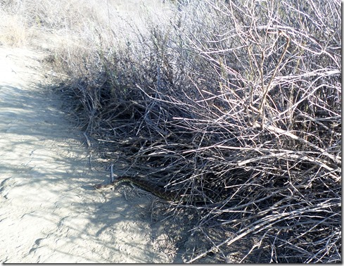
SAMSUNG CAMERA PICTURESAbout a week later, I got in another 7 mile trip in Aliso/Wood Canyons.   This time, I decided to start at the top of the park instead of in the canyon like I usually do.  I parked my truck at Moulton Meadows in Laguna Beach and in a trepid manner made my way down another treacherous decline – this one called Mentally Sensitive.  A rattlesnake caught me by surprise on that tiny single-track.  But I noticed it in time to steer clear and even catch a photo.  After reaching Wood Canyon, I took that trail to Mathis, which is a nice climb out back to the ridge. On the ridge I spotted my second rattler, and was able to snap another snake photo. 

Some scenes from my last summer trail run:

Toward the top of Mentally Sensitive:SAMSUNG CAMERA PICTURESSAMSUNG CAMERA PICTURES

Snake #1:SAMSUNG CAMERA PICTURES

Looking down from West Ridge onto Laguna Canyon Road:SAMSUNG CAMERA PICTURES

Snake #2:SAMSUNG CAMERA PICTURES

Caught up.  Now I can rest easy.

Wednesday, June 17, 2015

Not Summer Yet

SAMSUNG CAMERA PICTURESGym day yesterday, I was back on the trails late this morning.  I opted for a medium sized loop in Aliso and Wood Canyons.   I ran first through Aliso Canyon, turned off onto Wood Canyon Trail and made the first quick left onto Meadows.  Meadows is roughly 1.5 miles long, with the first half mile being relatively flat – exposed, but flat.  The remaining mile, still exposed, is a switchback with quite a climb, not quite brutal, but tough indeed.

 SAMSUNG CAMERA PICTURES

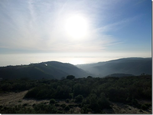
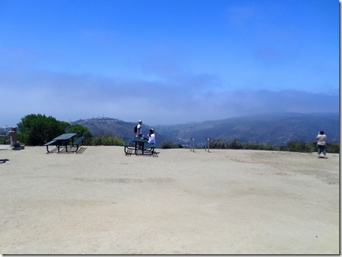
Though we were socked-in back at my house – the sun shined brightly in the canyons.  The marine layer hovered just offshore, hiding the Pacific Ocean.  My view from Top of the World was misty.  And I got some cool breezes because it’s not quite summer yet.  

SAMSUNG CAMERA PICTURES

I struggled to pick up my speed for the last 4 miles of this 9.5 mile run.  The run down Mathis, though downhill, was still tough – a good heat training trick, since there is absolutely no shade.  I figured that if I averaged a better pace than normal, I’d have enough time to get some grocery shopping done before tending to the rest of my day.  I managed that, but it came at a price.  Not talking about the standard prices, like eyes stinging from sweat and some overheating (got that though too).  I’m talking about that dang foot trouble.  Oh well.  I went off to my afternoon meeting with a limp, then got so busy for the rest of the day, that I neglected to stretch and take care of the foot.  Doh!  I guess I could still do it tonight before I go off to bed.  But I probably won’t.  At the very least, I will tape.  Winking smile

6 17 15

9.42 miles, 1,164’ elevation gain

Saturday, May 9, 2015

Later

What do you do when your running is suffering (utterly failing), you doubt that you even want to do it anymore, and you can’t find time to pull your wits together and figure out what to do about it?  Well, um . . . you get out there and run when you can, and figure it out later.  That’s what I say.  Later.

Later.  I like that word.

Let it be said. Let it be done. 

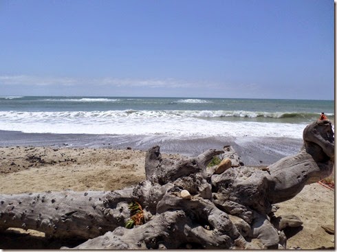
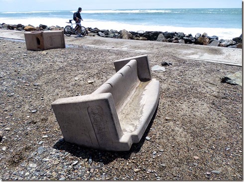
SAMSUNG CAMERA PICTURESMonday, after making lunches and breakfasts I took off out my front door for a run along the southern beaches.  Word was, waves had been ten to twelve feet the days prior.  Although we live a mere half mile from the sand, I had not ventured down to see the spectacular show.  Monday, the waves were still strong, but evidence of the past day’s destruction was stronger.  What used to be asphalt parking lots were covered with sand and rocks.  The volleyball courts in the sand were washed away.  Cement benches and trash receptacles were strewn about like toys. 

SAMSUNG CAMERA PICTURESSAMSUNG CAMERA PICTURES

I had to pick up my pace some to get home in time.  In all, I ran 5.12 miles (8.24 km), with a lovely flat 171’ (52.12’) of elevation gain.  After this, I picked up boy number one from school, prepped to teach a PowerPoint class, then picked up boy number two, showered, dressed, ate dinner and drove off to teach my one class for the day. 

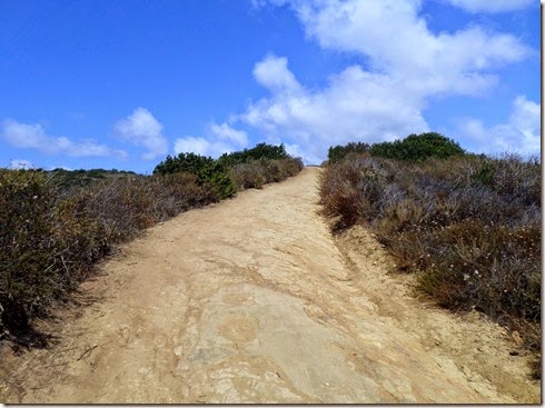
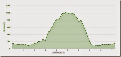
I did not get out again until Thursday – and it took several hours after waking at 6AM.  Of course there were lunches to pack, breakfasts to make, boys to drop off at school, not to mention two cups of coffee to down.  But I also needed to do some grocery shopping.  Finally at about 10:30 AM, I hit the trails in Aliso/Wood Canyons for a good-size loop up to Top of The World for a grand view of the Pacific Ocean.  Word was that rain would fall soon, but the skies were blue when I set off.  Fearing rain, not to mention being squeezed for time, I cut Wood Canyon short and ran up Mathis – the very first trail I ever took to the top.  Honestly, I hiked much of Mathis on Thursday, and I was okay with that.  Hell, it’s pretty close to a miracle that I can make it up Mathis without crawling, or stooping beneath the shade of a shrub and sobbing for that matter. Winking smile 

SAMSUNG CAMERA PICTURES

5 7 15

In all, I put in 9.3 miles (14.97 km) with 1,140’ (347.47 m) of elevation gain. Mere sprinkles of rain fell during it all, but winds were strong.   Back at home, I showered and got ready for an AB86 meeting at the local community college in a record fifteen minutes.  (I didn’t have time to do my hair, but I was clean. SmileI jumped in the truck barefoot, knowing that I had some black pumps in the back seat, and drove my oldest up at the high school for a study session as I headed off to my meeting.  Hardy laugh . . .  when I got a fright after my son peered toward the back seat and said, “Why is there only one shoe on the seat?”  He knew I was rushed and thought that was a funny joke.  Me, not so much so.)

Friday, I spent all day at a seminar, of which I was a break-out group facilitator.  After the break-out session, I presented our discussion in front of the entire seminar crowd.  And when I didn’t think that I would feel nervous at all (because I am so used to speaking in front of groups of adults), I found myself quite nervous.  That wiped me out.  I mean, really!  I am 50 years old, I speak in front of people lot of times!  However, speaking in front of students is a completely different thing than speaking in front of colleagues and superiors in your field.  Whew!  I crashed hard Friday night. 

Finally, this morning (Saturday) I hit the trails again around 11 AM in Las Flores.  I took Tijeras Creek Trail down to Arroyo Trabuco Trail (a semi-usual stomping ground).  With a down pour of rain on Friday, I hoped for full creeks.  But alas, they flowed only slightly fuller than the last time I visited these trails. 

It was a difficult time this morning with dark cloudy skies.  I felt tired and depressed, but I put my head down (I know, bad form) and ran nonetheless.  At one point, I came up on a man carrying a giant cross covered with red and white roses on this lonely trail.  Following closely behind him were at least one-hundred other hikers, many with red and white roses in their hair.  How odd this felt to encounter so many other people on a trail that I rarely see one other soul.   Their presence was so spectacular I wanted to snap a photo, but then re-thought that, since they were on some type of religious journey.  I didn’t want to intrude on that.  They definitely lifted my spirits for part of this run.   I always fin it uplifting to encounter other travelers along a lonely road. 

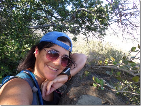
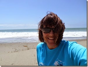
SAMSUNG CAMERA PICTURESChubby me, hitting the trails (and I don’t mean chubby as a derogatory term, but merely a descriptive word because I am a little frustrated about being out-of-shape – but I will overcome!):SAMSUNG CAMERA PICTURESSAMSUNG CAMERA PICTURESSAMSUNG CAMERA PICTURES

I got in 9.72 miles (15.64 km) today along Arroyo Trabuco, with 650’ (198.12 m) of elevation gain.  The week’s not over, and my feet managed twenty-four miles running.  And as usual, I am definitely better for it.  Later I will think about what the hell I am doing and what my plans are.  Until then . . . I will smile.  That’s all I can promise, a smile.