Southern California finally got some rain. Two days of rain! And we didn’t drown. And we didn’t flow away.  After the rains, I got two days in a row of running. Not two WHOLE days, but some hours worth, (while struggling, suffering way too early from fatigue). Still I got, two glorious days, plodding one foot in front of the other, as fast as I could muster.
Day One: Three Beaches
We have five beaches (or 6 or 7, depending how you count) in my town. Three of those beaches, the northern beaches, are adjoined along one long sandy strip, providing a nice 2+ mile stretch to get your feet moving: Monarch Beach, Salt Creek and Dana Strands (AKA The Strands). I decided early on Thursday, after getting the boys all off to school, that I would run the northern beaches, as all my coastal trails were closed due to “wet and muddy conditions.”
I parked on Camino Del Avion, and ran down the bike trail to Salt Creek State Beach. It’s over a mile along that bike path that runs adjacent to Monarch Links, a golf course with green belt views and memories of our early life in The O.C. My husband and I lived on the other side of this golf course, across the street from Salt Creek Beach for our first ten years here. It was easy living back then, though we didn’t know it. We should have known it – I mean, come on, though we both worked 40+ hour weeks, and I was working on my bachelor’s degree for some of those years, evenings consisted of walks on a lonely beach, and solo dips in the community pool. Weekends, well . . . after laying around in our sun-drenched living room, we’d pack up our back packs, and head down to the beach for the entire day – THE ENTIRE DAY. Hubby would fish in the surf, catching the nights’ dinner. I’d write letters on pink stationary, write in my journal, read a novel, or better yet, work on my novel. Occasionally, we’d jot off to the headlands, which seemed so far away (but is only about .75 of a mile away according to Thursday’s garmin recording). Back then, we didn’t head back up to our apartment until nearly every beach-goer had gone home. I’m not gonna say, “Those were the days,” because I wasn’t a runner then (I was a roller blader, a swimmer, a jazzersizer and OMG a smoker!), so I was missing out on a bunch – but they were wonderful days nonetheless.
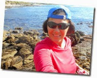
So there I was this past Thursday, trotting (yes trotting) back down to the beaches that I spent so many countless hours in the early years of my history in The O.C. I wasn’t missing those days. They just occasionally kissed my mind as I took in new times on these same beaches – this time, approaching 50 years old, with three sons and a wild-crazy home, downtown in the same beach resort.
As soon as my feet hit the sand on Salt Creek Beach, I took a right and headed toward Monarch Beach. Problem with the recent rains – Monarch Creek flowed heavily into the ocean. There was no hopping this without getting my feet wet.
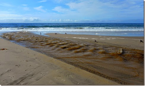
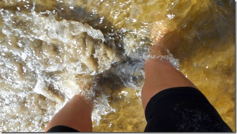
With my heart intent on running Monarch, I took a seat in the sand. There were few people on the beach – a thong-bikini clad lady ran barefoot along the sand. A gentleman did pushups up by the dirt trail. I unlaced my shoes, shoved my socks inside and not so gingerly trudged across Monarch Creek. My feet sank into the wet sand, as my mind relished the cool rushing water.
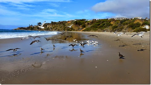
On the other side of the creek I was free! Free to conquer the remainder of Monarch Beach. Birds barely flinched as I trotted up on them barefoot in the sand.
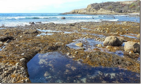
I did some boulder “running” to practice for Calico which is about a month away. These rocks however, unlike the ones that don’t seem to move in the desert, wobbled like teeter-totters when I pounced on them. I only fell once – it was a hard solid fall, with the ground giving no resistance. I pushed myself back to my feet happily unscathed.
The rocks along Monarch Beach:
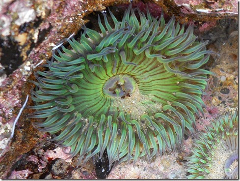
 After Monarch, I ran back across the creek (taking my shoes off again), ran along Salt Creek, and then The Strands. I stopped when I hit The Headlands where I photographed some sea anemones and watched the waves crash up on the rocks.
7.25 miles
Day Two: Mentally Sensitive / Mathis Loop
The coastal trails in Aliso/Wood Canyons opened back up on Friday. Grudgingly, I had to come to terms with a nagging ankle problem that I believe is not really an ankle problem, but a heel problem. My hunch is that the stiffness and low-level pain that I’ve been denying is related to my on-going plantar fasciitis. Frequent calve stretching along Aliso Creek Trail alleviated the situation within about the first mile (which further points to a plantar fasciitis problem).
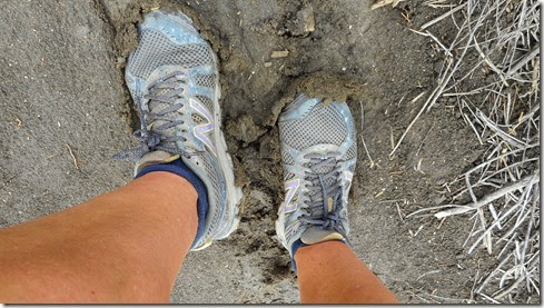
Anyway, the trails were muddy, and my climb up Mentally Sensitive proved quite strenuous. I worked up quite a sweat, as I slid back three feet for practically every foot of progress (fun!).
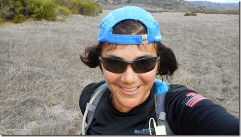

In all, I covered 10.7 miles, with 1,274’ of elevation gain. Felt good. And I was tired.

 digging this long gradual down hill stuff. But boy did I pay for it. From Wood Canyon, I took Meadows Trail on over to Mentally Sensitive, which I once re-named Psycho Path, and for good reason. I struggled immensely climbing this bastard of a trail. There really is no relief, and as you can see from the elevation chart below, the climb is steep as hell. Thankfully, it was short. But oh my lord. My pace was probably somewhere around a 40 mile minute. I may not take run that loop again for a while.
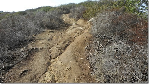
 Running down Cholla Trail into Wood Canyon:
 Starting up Mentally Sensitive (Psycho Path!):
 1,271’ gained, 10.3 miles:
")
")


