Two day total: 31.44 miles


 Oh, how I have digressed. My journey back to Hot Springs
Canyon began at the beginning of this month -- March 1, in fact. I got a really
late start because I had to pull over and make some unexpected phone calls. It
may have been as late as 1 pm before I arrived to Hot Springs Canyon, the
location I chose because it was semi-close and all my local trails were closed.
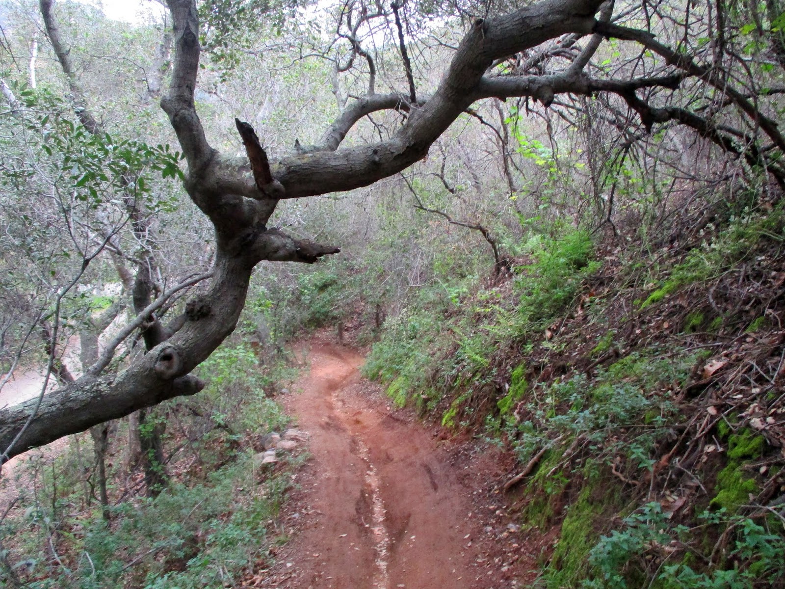
I meandered a bit about the creek, which was clear and rushing. Then I gave
myself two hours up before I needed to turn back to make sure that I’d get in
before dark (we hadn’t changed the clocks yet). The weather was cool and breezy,
the skies gray. Little fields of wildflowers were splattered all over the
slopes. And moss and ferns were wrapped around boulders and rocks in the shady
areas. Wow. This was no summertime San Juan Trail. This was beautifully cool weathered- springtime San Juan Trail. 8.10 miles on this hike;
1,713 elevation gain.
Oh, how I have digressed. My journey back to Hot Springs
Canyon began at the beginning of this month -- March 1, in fact. I got a really
late start because I had to pull over and make some unexpected phone calls. It
may have been as late as 1 pm before I arrived to Hot Springs Canyon, the
location I chose because it was semi-close and all my local trails were closed.
I meandered a bit about the creek, which was clear and rushing. Then I gave
myself two hours up before I needed to turn back to make sure that I’d get in
before dark (we hadn’t changed the clocks yet). The weather was cool and breezy,
the skies gray. Little fields of wildflowers were splattered all over the
slopes. And moss and ferns were wrapped around boulders and rocks in the shady
areas. Wow. This was no summertime San Juan Trail. This was beautifully cool weathered- springtime San Juan Trail. 8.10 miles on this hike;
1,713 elevation gain.


 Well! The day was absolutely lovely with big puffy clouds
and blue skies. Spring flowers were bursting all over the place. I could see down
to the Pacific Ocean and for miles into the Cleveland National Forest. It
really was amazing. But my time was not good. Cocktail Rock was slightly
further than I expected. The weather was super cold at the rock, and the wind
began to pick up. It took me slightly more than 3 hours to arrive there, and I
wasn’t going to turn around and go straight back. I did recorded some video,
took in the scenery. By this time though, I basically had 1 hour and 45 minutes
to make the trip back, which I could conceivably do if I ran it. Funny thing
was, my phone rang when I was hanging out at Cocktail Rock (did not expect any
service there!). Learning that I had cell service, I gave my husband a call to
let him know that he would have to take our son if I didn't make it in time. I
had fun running back (as it was basically all down hill). But the trail got too
technical in some parts, and being that I’m not really practiced at running
this level anymore, I slowed it down during those portions. I did not
make the return trip in 1 hour 45 minutes. But I was close. It took me just a
little over two hours. Total distance: 13.11 miles, 2,546’ of elevation gain. And that is why Hot Springs Canyon 3 times!
Well! The day was absolutely lovely with big puffy clouds
and blue skies. Spring flowers were bursting all over the place. I could see down
to the Pacific Ocean and for miles into the Cleveland National Forest. It
really was amazing. But my time was not good. Cocktail Rock was slightly
further than I expected. The weather was super cold at the rock, and the wind
began to pick up. It took me slightly more than 3 hours to arrive there, and I
wasn’t going to turn around and go straight back. I did recorded some video,
took in the scenery. By this time though, I basically had 1 hour and 45 minutes
to make the trip back, which I could conceivably do if I ran it. Funny thing
was, my phone rang when I was hanging out at Cocktail Rock (did not expect any
service there!). Learning that I had cell service, I gave my husband a call to
let him know that he would have to take our son if I didn't make it in time. I
had fun running back (as it was basically all down hill). But the trail got too
technical in some parts, and being that I’m not really practiced at running
this level anymore, I slowed it down during those portions. I did not
make the return trip in 1 hour 45 minutes. But I was close. It took me just a
little over two hours. Total distance: 13.11 miles, 2,546’ of elevation gain. And that is why Hot Springs Canyon 3 times!


 We have been transformed into a green colored state with all the rain that we’ve had the past several weeks. Green hills and mountains surround us now. It really is remarkable. I get out to the trails when I can in between rains. Most of my local trails are closed, so I always shimmy off to the trails that open sooner than the others. One of those trails is Arroyo Trabuco, which I set out on over a week ago (February 24) for a nice long hike (with some running, because I got behind in my schedule due to all the creek crossings). I put in 13.17 miles and waded through the stream a dozen times. I didn’t mind the wet feet, but oh did it feel wonderful at the turnaround point in O’Neill Park when I replaced my socks with a dry pair. Almost nothing feels better than replacing soggy socks with a new dry pair.


