I have come to conclude that it’s a good thing that the
state and county parks have been closed so much lately “due to wet and muddy
conditions.” I was getting so annoyed at OC Parks, but now I am fine. Really, I
am fine. All these closed parks have lead me to a wonderful revisit -- a
revisit to Hot Springs Canyon. And what an unexpected delight this has been.
Hot Springs Canyon is toward the bottom of the mountain off
of Ortega Highway (In the Cleveland National Forest on the Orange County side).
The turnoff is by the fire station and the same road that you take to LazyW
Ranch. Old Goat’s Chimera (100 mi. race) has an aid station in this canyon. It’s
where the runners come off a long 12 mile downhill on San Juan Trail. And then
they must turn around and repeat those 12 miles back into the Blue Jay
campgrounds. I have frequently travelled San Juan Trail over the past decade.
But I almost always stay toward the top of the trail and go off on other
junctions like Chiquito Trail and The Viejo Tie. A couple of times I have
ventured up San Juan Trail from Hot Springs Canyon. Once, some years back, I
ran up the trail from Hot Springs Canyon to Cocktail Rock. One thing for sure,
during the summertime, San Juan Trail is a bear. It can get brutally hot, heat
stroke kind of hot, if not taken seriously. It’s completely exposed until you
get in pretty close to the campgrounds. So, you’ve got about 7 or 8 miles of uphill
sun beating down on you if you want to make the trip on San Juan Trail from Hot
Springs Canyon into Blue Jay campgrounds.
 Oh, how I have digressed. My journey back to Hot Springs
Canyon began at the beginning of this month -- March 1, in fact. I got a really
late start because I had to pull over and make some unexpected phone calls. It
may have been as late as 1 pm before I arrived to Hot Springs Canyon, the
location I chose because it was semi-close and all my local trails were closed.
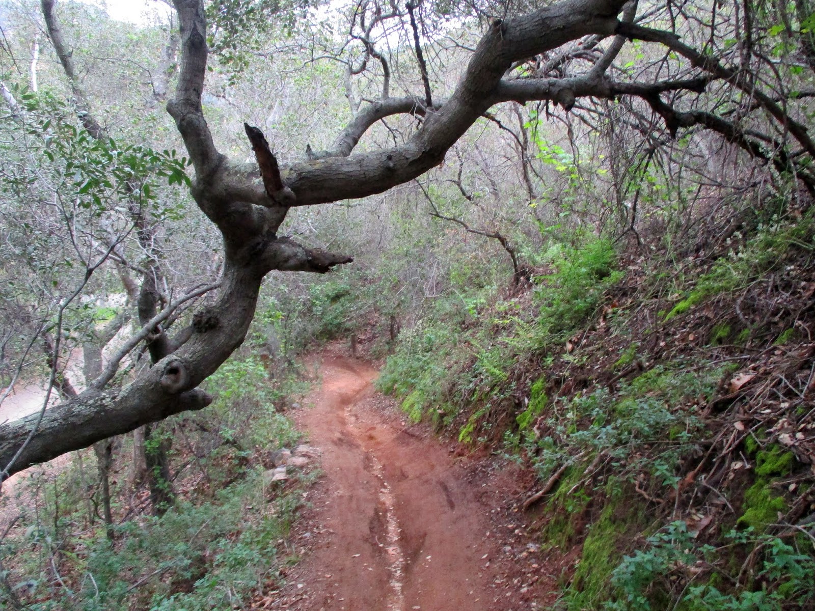
I meandered a bit about the creek, which was clear and rushing. Then I gave
myself two hours up before I needed to turn back to make sure that I’d get in
before dark (we hadn’t changed the clocks yet). The weather was cool and breezy,
the skies gray. Little fields of wildflowers were splattered all over the
slopes. And moss and ferns were wrapped around boulders and rocks in the shady
areas. Wow. This was no summertime San Juan Trail. This was beautifully cool weathered- springtime San Juan Trail. 8.10 miles on this hike;
1,713 elevation gain.
Oh, how I have digressed. My journey back to Hot Springs
Canyon began at the beginning of this month -- March 1, in fact. I got a really
late start because I had to pull over and make some unexpected phone calls. It
may have been as late as 1 pm before I arrived to Hot Springs Canyon, the
location I chose because it was semi-close and all my local trails were closed.
I meandered a bit about the creek, which was clear and rushing. Then I gave
myself two hours up before I needed to turn back to make sure that I’d get in
before dark (we hadn’t changed the clocks yet). The weather was cool and breezy,
the skies gray. Little fields of wildflowers were splattered all over the
slopes. And moss and ferns were wrapped around boulders and rocks in the shady
areas. Wow. This was no summertime San Juan Trail. This was beautifully cool weathered- springtime San Juan Trail. 8.10 miles on this hike;
1,713 elevation gain.

Trip number two into Hot Springs Canyon this month was
unplanned. Thursday, March 7, my husband and I had planned a hike in Caspers
Park to the San Juan Hot Springs (we have never been). I should have known,
because Caspers is part of the county park system, that it was closed due to
“wet and muddy” conditions. So, we drove a few miles and turned into Hot
Springs Canyon hoping we could find a way to the hot springs from that
location. Turned out that the entire perimeter of Caspers is fenced. We did
find a spot to squeeze through, but being that the place was so heavily fenced
and plastered with no trespassing signs, we decided to squeeze back through the
barbed wire fence and did a short creek hike instead. We crossed the creek several times before
reaching LazyW Ranch. We took in every cabin (as close as possible). Everything was clean and green. Some of the cabins had the creek flowing just past their front doors. What a lovely spring canyon.
4.03 miles on this hike, plus a little more walking around at the Tree of Life
Nursery down the road a bit. (Wonderful nursery with all California native plants).

The very next day, Friday March 8, I got back out to Hot
Springs Canyon. I had five hours. I really needed to get back to the car by 4pm
so that I could bring my son to an appointment. (Just in case though, I had
left directions on the kitchen counter so that my husband could bring him if I
didn’t get back in time.) My goal was Cocktail Rock, which I estimated was
around 6 miles away (uphill).
 Well! The day was absolutely lovely with big puffy clouds
and blue skies. Spring flowers were bursting all over the place. I could see down
to the Pacific Ocean and for miles into the Cleveland National Forest. It
really was amazing. But my time was not good. Cocktail Rock was slightly
further than I expected. The weather was super cold at the rock, and the wind
began to pick up. It took me slightly more than 3 hours to arrive there, and I
wasn’t going to turn around and go straight back. I did recorded some video,
took in the scenery. By this time though, I basically had 1 hour and 45 minutes
to make the trip back, which I could conceivably do if I ran it. Funny thing
was, my phone rang when I was hanging out at Cocktail Rock (did not expect any
service there!). Learning that I had cell service, I gave my husband a call to
let him know that he would have to take our son if I didn't make it in time. I
had fun running back (as it was basically all down hill). But the trail got too
technical in some parts, and being that I’m not really practiced at running
this level anymore, I slowed it down during those portions. I did not
make the return trip in 1 hour 45 minutes. But I was close. It took me just a
little over two hours. Total distance: 13.11 miles, 2,546’ of elevation gain. And that is why Hot Springs Canyon 3 times!
Well! The day was absolutely lovely with big puffy clouds
and blue skies. Spring flowers were bursting all over the place. I could see down
to the Pacific Ocean and for miles into the Cleveland National Forest. It
really was amazing. But my time was not good. Cocktail Rock was slightly
further than I expected. The weather was super cold at the rock, and the wind
began to pick up. It took me slightly more than 3 hours to arrive there, and I
wasn’t going to turn around and go straight back. I did recorded some video,
took in the scenery. By this time though, I basically had 1 hour and 45 minutes
to make the trip back, which I could conceivably do if I ran it. Funny thing
was, my phone rang when I was hanging out at Cocktail Rock (did not expect any
service there!). Learning that I had cell service, I gave my husband a call to
let him know that he would have to take our son if I didn't make it in time. I
had fun running back (as it was basically all down hill). But the trail got too
technical in some parts, and being that I’m not really practiced at running
this level anymore, I slowed it down during those portions. I did not
make the return trip in 1 hour 45 minutes. But I was close. It took me just a
little over two hours. Total distance: 13.11 miles, 2,546’ of elevation gain. And that is why Hot Springs Canyon 3 times!


No comments:
Post a Comment