TALES FROM THE TRAIL (AND SOMETIMES THE ROAD TOO)

Showing posts with label Santiago Truck Trail. Show all posts

Sunday, July 5, 2015

4th of July Run on Santiago Truck Trail

I had already postponed a run this week with my Sheila, a long-time trail running friend.  So, as I tossed and turned past midnight, with the alarm set for 4:45 AM, I decided I was just gonna have to buck it up if I wanted to get out for an early morning run on the 4th of July.  I needed a run with a friend.  And I needed a run in the mountains.  That only way that was going to happen was to go out with the dawn patrol.

And so, fireworks and firecrackers rang out through the night as I attempted to get even a few winks of sleep.  I recall waking at 2:00 AM, again at 3:00 and my God, once again at 4:00 when I told myself that I still had forty-five minutes to gain a wink.  (And I do believe that I slept most of that time.)

When 4:45 AM rolled on in on the great U.S. holiday, the 4th of July, I was out of bed, slowly but surely getting dressed.  I pushed the button on my two-cup coffee maker and packed my vest.  I brought along about 60 fluid ounces of water (mixed with Nuun), a hat, sunglasses, a red bandana, my garmin, an Ipod which I probably would not use (but I never leave home without), a knife, my phone, lip balm, toilet paper (which I probably would use), ibuprofen, a camera (which I would definitely use),  and believe it or not, a jacket on this 4th of July – oh, and I believe my driver’s license was still tucked deep in my pack from my last run (and I think it’s still there).     

The fog was thick as I drove through Rancho Santa Margarita and even thicker along Santiago Canyon Road.   I attempted to answer a call from Sheila several times, mostly with no response, a couple of times I could hear her voice, but she could not hear mine.  I worried that she had perhaps cancelled, so I decided that as sleepy as I was, I’d go ahead and run anyway if that was the case. 

Eventually, we met up at the corner of Modjeska Canyon Road and Santiago Canyon Road and she followed me as we drove the windy road up to Modjeska Grade were we found a spot to park.  We took that asphalt, uphill road for about a half a mile before reaching the trailhead to Santiago Truck Trail.   The weather was cool, almost cold, the clouds thick and air misty.  The moon was still high in the sky as we climbed up above the low clouds.  We didn’t see another soul as we set off ascending that popular, yet remote trail named Santiago Truck Trail.  Within a half mile (I’m guessing), we stopped to take off our jackets and tied them around our waists. 

SAMSUNG CAMERA PICTURES

SAMSUNG CAMERA PICTURESThere’s quite a bit of uphill climbing along Santiago Truck Trail – hiking kind of climbing for me during parts of it.  But there’s also some rolling hills, and with the cool weather and low-lying clouds, the climbs were very bearable.  I lost my red bandana along the way, but didn’t fret, as I was certain that I’d find it on the return trip.  (I of course did not find the bandana, but was satisfied that in my mind, someone else had found it, and that it would come to good use in their travels.  I was happy in the fact that I could pass on something that I had held for many years.)

As I mentioned earlier, the trails were empty when we first set foot on them.   I’m not certain when we saw our first travelers, but I am certain they were cycling.  All the travelers that we eventually came upon (and there were many) rode a bike.  Except for one:  there was a gentleman, wearing a vest pack like Sheila and I.  We met him on the return, on an uphill as he was traversing down.  He was fresh and smiling.  We smiled too, but fresh . . . not so much. 

But I digress, and have gotten ahead of myself.  We ran out to a flag, which flies across from the vulture crags. It’s also the location where the top of The Luge, a popular bike trail, meets. I had hoped that the flag measured the 5 mile mark, but recalled from earlier runs, that it would measure short.  Ends up, it was just shy of 4 miles.  So, after signing the registry there, we took off further to make the “out” portion measure precisely 4 miles before turning back on the trail toward our cars. 

SAMSUNG CAMERA PICTURESSAMSUNG CAMERA PICTURESSAMSUNG CAMERA PICTURES

I noticed more than one bunny cross our path.  And though I saw no snakes, I spotted their trails here and there.  With Sheila running out ahead, and about two miles remaining in our trip, I got to witness a tiny rockslide not too far from my feet as a spray of dirt spit forward from my left and a small boulder tumbled down and shot out onto the trail. 

Fossil Rock with about a mile to our cars:SAMSUNG CAMERA PICTURES

With only 8 miles covered on Saturday’s lovely run, I wasted my feet.  Wasted.  Particularly the left foot which throbbed pain from its arch for the remainder of the day.  My family and others in the neighborhood walked to a nearby bluff where we watched fireworks shot off from the marina.  I suffered pain on the walk there and back.  My relief was immense when my husband taped my arches later that night. 

That’s just the way it is right now.  I’ll take it. 

7 4 15 a

Friday, July 3, 2015

The Trespasser

I often wondered about a particular trail that I’ve seen while running Santiago Truck Trail on my way to Old Camp.  After studying maps and looking at satellite images, I concluded that the trail in question is Joplin Truck trail, and it winds down the mountain dumping out somewhere in Rose Canyon.  From the maps and images I couldn’t precisely figure out where to catch Joplin Truck Trail in Rose Canyon.  I decided that my best bet in figuring out Joplin was to take it from above -- from Santiago Truck Trail.  However, the trip to the junction from Modjeska Canyon is around seven miles.  But from Trabuco Canyon, there’s a hellish trail (hellish because of the steep grade and exposure) that’s only about two miles to Joplin Truck Trail.  

Yesterday, Thursday July 2nd, in the middle of summer, during the afternoon, I thought it would be a good idea to finally check out Joplin Truck Trail.  I wanted something hard.  And I got it.

SAMSUNG CAMERA PICTURESI parked my truck at the mouth of Trabuco Canyon, off of Plano Trabuco Road, just before Rose Canyon, and I trekked up the road into the canyon.  I covered a couple flat miles, past large sections of fenced properties riddled with “No Trespassing” signs.  At about two miles I hit Cadillac Trail which quickly ascends into the Santa Ana Mountains.  Cadillac Trail is named so, I believe because of the wrecked car a short distance up.  I have no idea if the car is a Cadillac.  It’s pretty smashed and all markings have been removed.  Maps name this trail Trabuco Creek Road.  

The trip up Cadillac was hot and steep.  Flies bit my legs, my arms.  And as I ascended the mountain, I noticed a couple trucks below make their way to Cadillac Trail. It was so lonely up there, I kind of hoped that one would attempt the drive up.  None did, they either turned around or headed further into the canyon.  I could tell 4WD’s had made the trip by the tire marks in the dirt.  There were also dirt bike marks, but no mountain bike tracks.  And occasionally, I’d see a footprint.  

SAMSUNG CAMERA PICTURES

In addition to the 70 fluid ounces in my hydration pack, I carried a bottle of water for the purpose of getting my bandana wet.  I frequently stopped to drench the bandana and wear it over my head or drape it around my neck.  The trek was extremely slow, and there was very little running involved.  I took mental notes of faraway trails I spotted in the distance.  And I explored all turn offs to discover which direction they travelled.  But I always went back to the main trail because my direction was up.  Up.  Up.  Up.

All the while, I could feel the tiny chunks of flesh being ripped from my legs by the flies.  A couple of times I found a bit of shade where I stopped to cool down and and the flies feasted on my flesh.  I noticed there were three types.  Some flies looked just like houseflies, except a little blacker and more than twice the size.  These flies took the biggest bites, but they also took a second before chomping so I often swatted them away before they bit.  There were also smaller flies with feathery wings.  They were black as well.  But these critters were much slower than the giant houseflies.  When I swatted them, I often killed or maimed the devils.  The third type of fly, that I didn’t identify until I sat in the shade, was an oblong insect, dark gray.  They wore what looked like a helmet, which made me think that they resembled little penises.  So, henceforth, I will call these flies penisflies.  Their bites hurt as well.  But as I got moving, the penisflies seemed to leave me.

SAMSUNG CAMERA PICTURESSAMSUNG CAMERA PICTURESWith about 3/4’s of a mile remaining before my turnoff, I came upon another hiker.  His face was red, and he hunched over slightly, presumably fatigued like myself.  He commented how difficult it must have been for me going up this trail because it was so difficult going down.  Quickly afterward, I came upon his hiking partner, a female who was taking the slope slowly.  Poor kids (though they weren’t actually kids, but younger than myself) had come a long way -- all the way from Cook’s Corner (I’m approximating a good 10 miles, and they had more than that to get back).  These two were the only people that I’d see on this adventure.  I hoped that I’d see them again when I closed my loop and headed back toward Trabuco Canyon. 

Cadillac Trail:SAMSUNG CAMERA PICTURESLooking back at The OC:SAMSUNG CAMERA PICTURES

Two full hours into my trip, I finally made the junction down to Old Camp (a mere four miles of travelling).  Before moving on, I found a sliver of shade where I sat and drenched my bandana.  Heading onward, I soon found a trail that went off to the left.  Unable to get a signal for my phone GPS, I hiked up that trail for a high point.  I came upon the black remnants of a campfire and very little evidence of the trail reaching further.  Fortunately, I got a signal and found that there was a more promising trail about a quarter mile away.  I ran the short distance and found an unkempt, eroded single track.  I thought this could not possibly be the trail, though I did discover some mountain bike tracks.  No foot prints though.  Fortunately, I got a signal to check out the GPS and sure enough, I had arrived at Joplin Truck Trail.  Though no truck would ever be able to traverse this terrain.  It was single-track in the truest sense.  Single file, no side-by-side running for sure.  The trail was overgrown, rocky and covered with ruts and erosion. 

I ran along Joplin Truck Trail exposed to great heat, no shade, but glory, glory, no flies.  An occasional breeze also helped out.  And I still had plenty of water in my bottle to douse my bandana.  All the while, I travelled in the opposite direction of Trabuco Canyon where I had parked my truck.  Though I checked frequently, I no longer had a signal to access the GPS.  

SAMSUNG CAMERA PICTURES

SAMSUNG CAMERA PICTURESSAMSUNG CAMERA PICTURES

Close to two miles down, the trail changed directions and I found myself running back toward Trabuco Canyon.  Orange County laid before me in all its glory.  I could see that clouds covered the Pacific Ocean.  And I could see Joplin Youth Center getting closer and closer. 

Joplin Youth Center is a lockdown correctional facility for very young (15 years and younger) felony criminals.  I know this because about 17 years ago, when I was pregnant with my first son I substitute taught for the county schools, which included “court schools” such as those located in juvenile hall, Los Pinos Boys Home, and Joplin Youth Center.  I accepted an assignment for Joplin back then, and recall driving a windy road through what I now know as Rose Canyon.  After passing through locked and guarded gates, I arrived to this facility full of wonder.  How could these young teen aged boys have gone so vastly astray at such a young age?  The center housed felons, rapists and murders among them.  I was some months pregnant at the time, expecting my own son.  I remember being weepy-eyed at the thought of mothers worrying about their criminally sentenced minors.  

I was terribly frightened to take on this assignment, more so than I was running down Joplin Truck Trail toward the facility on this hot summer day (where I probably had a greater chance of dying than I did taking on that substitute teaching job at Joplin Youth Center).  Turned out, the boys were terribly charming.  Visibly pregnant, they dotted over me, offering to do everything -- get the television and VCR, find me a chair in the lunchroom, even serve me lunch.  The way my assignment worked was this:  I was locked into the classroom.  Guards roamed the hallways with keys.  I kept a walkie-talkie with me.  If I needed help, or needed the classroom unlocked for any reason, I could radio the guards.  Here’s what happened:  within the first fifteen minutes locked in my classroom, my walkie-talkie disappeared.  Fortunately, after (nervously) chuckling out loud and demanding its return, one of the boys fessed up and handed it over.  There were no further incidents that day, except for my amazement over how these seemingly wonderful boys could be so ruthless in society.  I never had the opportunity to return to Joplin Youth Center before now, and here I was, a fifty year old woman, running straight toward it down the mountain on a scorching, hot summer day. 

With some of the outbuildings just in sight, I came upon a sycamore grove.  There was a particularly shady spot where a waterfall obviously made its home during our wetter years.  And then, bam -- my trail ended.  It was washed out.  But I was too committed in this loop to turn back.  So, I gingerly made my way down a ravine, butt sliding where needed, and half crawled my way back up to the trail on the other side, thrilled that I would soon be in Rose Canyon.  But I worried too.  What if the trail ended at the boys’ home?  What was I to do then?  Could I skirt along the lockdown facility?  If so, would I be accosted by authorities?  In preparation, I hid my camera.  And I also took the knife off my pack and buried it in my pocket (which of course made it now a concealed weapon -- doh!)

Washed out:

SAMSUNG CAMERA PICTURES
Back on the trail:SAMSUNG CAMERA PICTURES

And then something happened that I did not expect.  The trail forked, but both ends of the fork were fenced off with barbed wire.  On the ground was a rusted sign that read Joplin Truck Trail, Cleveland National Forest.  Erected in its spot was a sign that read:  No Trespassing. Do Not Enter, Correctional Facility.  I did not have enough fluids to return the way I came. I cannot say that I thought my out my situation carefully.  Instead, I scampered along the barbed fences hoping that they ended in the brush.  But they did not.  The barbed wire scaled up and down the canyon walls.  I considered trying to telephone the assholes at Joplin Youth Center and demanding that they let me in so that I could pass through, else I die on this forsaken trail.  (I was pissed!)

“Okay, okay, THINK!”  There’s got to be a way through this (last choice phoning Joplin Youth Center).  I shook the gate, hoping that it would open enough for me to squeeze through.  I tried stepping down on the barbed wire.  And then I noticed that a portion of the wire across the left fork seemed to have a wider opening than the rest.  And so, I got down on my knees and attempted to crawl through.  My pack got caught, and the water bottle flew out, landing on the other side of the fence, way out of reach.  I shimmied my pack and hat off stooped down there between the barbed wires, hoping that would be enough to get me through.  No luck.  And so I scooted back out, grabbed my pack and hat from the other side and wistfully waved my bottle of water good-bye.

Next, I inspected the fence along the right side of the fork.  That’s when I noticed that some of the wire directly in front of the No Trespassing sign was not barbed.  Hallelujah!  Wait a minute . . . did I say in front of the sign?  That’s right.  I was standing on the side of the fence that the sign warned not entering!  I hoped the non-barbed section, free and happy to be making my way down Joplin Trail legally.  

The trail was steep, but it was shady.  It was lonely and spooky too.  With no GPS signal I felt confident that the trail lead in the right direction even though I found no tracks.  Much to my dismay however, I encountered my next sign.  This sign warned me also that I was trespassing, this time upon a wilderness preserve.  Hell.  I really had no choice but to keep on going, checking frequently for a phone signal.   More and more overgrown, I feared this portion of the trail had not been walked upon for a long while.  And then another No Trespassing sign.  And then another.  Eventually, I got a phone signal, but I could not see the image on my gps – it was too dark.  I was able though to phone home and talk to my husband.  I mentioned briefly where I was and that I hoped to be reaching Rose Canyon shortly.  But overall, I was pretty much going to be arriving home late.  I had already passed the 6 mile mark, which was what I had approximated this run to be.  

Looking back on Joplin Truck Trail after hopping the fence:SAMSUNG CAMERA PICTURES

Continuing on through the “Preserve”:SAMSUNG CAMERA PICTURES

Eventually, I made it to a paved road in Rose Canyon.  But I was locked in, and needed to hop this little fence to get back into legal territory. 

Just call me the trespasser.  Winking smile

I guess it’s time to mark up my maps. 

SAMSUNG CAMERA PICTURES

7 2 15 a

Tuesday, December 23, 2014

Back to Old Camp

It’s probably been three years since I’ve been to “Old Camp” (a historical American Indian Camp in the Cleveland National Forest).  Last week Santiago Truck Trail encouraged me to head back there again.  Monday, I ran with my friend Kelly, a smiley, optimistic runner, whom every runner should have the great opportunity to run with.  She is funny, witty and pretty – a funny lady with a lot of patience.  Usually, I’m a lone runner.  That’s not always good.  Why?  Because left to my own devices, well . . . let’s just say, it doesn’t always end well (or at the very least, I don’t always get what I should from the experience).

Monday, I got what I should from the experience.

My friend Kelly is a blessing.

She helped me stay in the present (THE ENTIRE 16.5 MILES)

View from Santiago Truck Trail (overlooking The OC and the Pacific Ocean):The Vulture Crags at approximately 3 miles on Santiago Truck Trail:Snack break in “Old Camp”:Climbing out of “Old Camp”:

This was one tough 16.5 mile run – one well worth it.  There were times (at oh, approximately the half-way point!! that I didn’t think I could take another step forward, yet I did –- this is what it is all about sometimes with me).  Thanks for reading!!  Merry Christmas.

12 22 1412 23 14 a

Saturday, December 15, 2012

The Last Trail is ALWAYS the Longest

My country mourned over a great tragedy yesterday when a madman burst into an elementary school and murdered twenty young school children and several adults.  Though we all mourn, this event, like other similar tragedies, divides us as a nation as we all weep for the poor families involved. We argue about gun control, public school responsibilities and mental health laws.  I have my opinions and in my sadness have expressed them. 

Today, I merely wanted to get away and run.  Rain fell down upon my windshield as I drove under darkness to Modjeska Canyon.   I had planned on a group run.  After waiting 15 minutes at the trail head, no one showed.  That’s okay.  I needed to get away.  In fact, I felt a little relieved that no one showed.   I felt a great urge to exist in The Now without interruption.  Though my mind travelled to the terrible happenings of yesterday, I forced myself to bring it forward to the present.  And though my mind travelled to the future, as in what should we do????  I again forced my mind to The Now.  And I ran 24 mountain miles for the teachers and children who were murdered, and their families.

The first 12 miles were up hill.  Some slight down hills existed, but overall, it was a 12 mile, cold grind. 

Harding Truck Trail:

At the top of Harding Truck Trail, I came upon one of the thousands of  “Four Corners” on Earth.  It had spectacular views of snow covered mountains from afar.  From there, I took one of the 4 paths, The Main Divide, toward Modjeska Peak, and ran upon crusted snow and ice.  When my feet hit, I could hear the crackle of broken ice crunch down – a delightful, delicate sound.  Often I had to run into the bushes, around giant frozen puddles.  I also needed to concentrate on a strong footing, else I slip.  So much time had passed since my last run to Modjeska Peak from this direction, that one false summit fooled me. (I just love false summits,” said no one ever!)

Four Corners:

Running up The Main Divide toward Modjeska Peak:

At about mile 12, I HAPPILY reached Joplin Trail.  I’ve only run Joplin Trail once; that was UP Joplin.  And I’ll tell ya, if I had come upon a sword during that trip, I would have thrown my self upon it.  Running down Joplin was a chore no doubt.  I ran on snow covered ground.  Though I could not pick up my pace much running down Joplin, the experience was joyous.  Rocks tumbled beneath my feet.  Moss grew upon the boulders.  I fell only once landing on my butt, and my hand slammed down on a jagged rock (that wasn’t so joyful).  I hopped over a spring that was not flowing on my last visit to Joplin.  And I even came upon crazy men struggling on bikes to make their way up this trail.

Just like when I ran up Joplin, I had to grab onto branches running down Joplin, else I fall flat on my face.  After my fall on my butt, I tripped hard once and nearly twisted my knee.  Best of all (besides the glorious snow covered single track), I ran beneath a gigantic tree that had fallen and created a sort-of-bridge over the path.

Eventually, I made it to “Old Camp.”  Here I took off the warm clothing and took out some fuel to consume.  As always when I stop, I turned off the music so that I could hear EVERYTHING.  I heard two men down by the stream.  After several minutes, I noticed that they noticed me.  And then oddly, one of them walked off, not assuredly, looking back at me, toward Joplin Trail.  He wore a pack on his back.  But he wore long pants and was obviously a hiker, not a runner.  Oddly, the other guy disappeared in the opposite direction.  And I had the sinking feeling that he was going to flank me, that is, make his way around the stream and come up behind me.

I got out of there quickly, and began running up toward Santiago Truck Trail.  On my way up, I looked down onto Old Camp, and SURE ENOUGH, that guy, had come around to what have been the back of me.  He looked up on to the road as I ran past.  And I continued running all the way to Santiago Truck Trail.  Though I got an odd feeling about those men, I’m going to believe that the first guy went off ahead because the other guy wanted to explore some more.  Still, I am very cautious and pay attention to everything.  I wasn’t going to take chances.

Joplin Trail:

Old Camp:

I felt great relief upon reaching Santiago Truck Trail.  It was however THE LONGEST TRAIL IN THE WORLD.  Isn’t the last trail always the longest?  I judged “how much longer” by the flag overlooking the vulture crags.  I knew when I came upon the U.S. flag, I had only about 6 1/2 miles left.  It took, of course, much, much longer than I imagined.  I was overjoyed when I finally spotted the flag from afar.  Still, I had about a mile before I actually reached it.   

Next anticipated spot was the trail head to Santiago Truck Trail.  It took flippin’ F O R E V E R.  I wasn’t overwhelmingly tired physically.  I was just tired, more so mentally.  When I finally spotted the trail head, it took me TWO  miles to reach it.  Then I ran another 1.5 miles back to my car.  I was moving pretty slowly in the end.  But it was all worth it, WELL WORTH IT.  Still, I couldn’t wait to get home to hug my boys. 

Santiago Truck Trail:Running Harding, MD, Joplin, Old Camp, Santiago Truck Trail, Modjeska Grade-Cyn 12-15-2012, Elevation - Distance

Sunday, March 25, 2012

How it went Down.

SO!  I’ve been a little overwhelmed and depressed over non-running issues.  When I showed up yesterday morning (Saturday) in Modjeska Canyon to run a giant loop run with a group, that I had planned for  weeks, I was asked an innocent question by one of my running friends.  In response I started crying!  CRYING!  I felt a little humiliated.  “Don’t cry, don’t cry, don’t cry,”  I told myself.  I don’t like making anyone feel badly or sad for me.  In public, I try to ALWAYS put on a happy face.

I quickly got my mind on running and my running friends were all sweet in helping me forget, especially Judi as we set off for a long, long running adventure into the mountains.

I had run all but one of the trails on this loop, some of them several times.  But I had never run up (or even down) Joplin Trail.  I also hadn’t been to a place called “Old Camp” in a few years, so I wasn’t confident on how to get there.

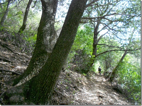
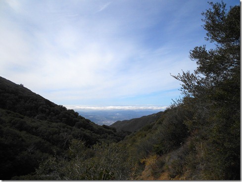
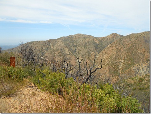
Our ran began on flat asphalt for just a short while, and then the climb began to the trailhead as we made our way out of Modjeska Canyon.  The weather was cool and beautiful.  Yes, beautiful.  On this particular morning, we could see the weather in the form of misty clouds. 

Running Santiago Truck Trail:

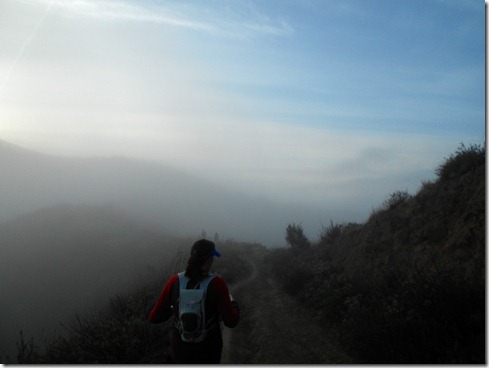
Lisa, Matt & Judi on Santiago Truck Trail:

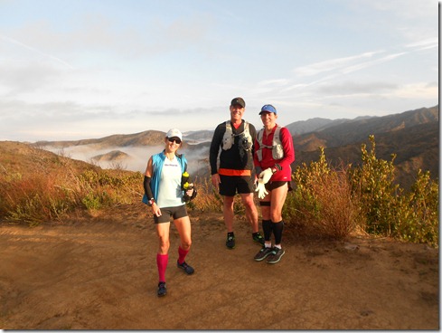
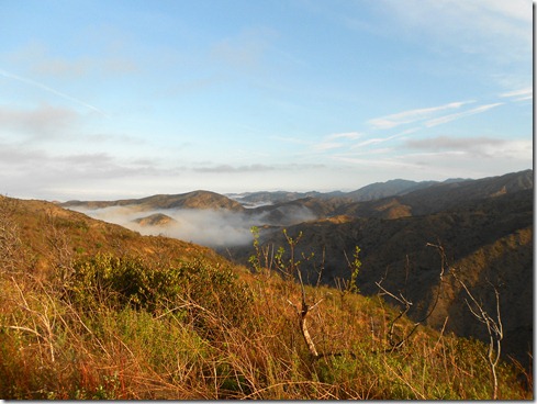
Brief stop to take in the beauty:

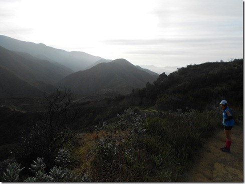
On the run again (photo compliments of Matt):527813_2943303817265_1101323848_32343814_1956340573_n

I’m unsure how far we ran before we came upon the vulture crags, which of course I didn’t take a picture.  However, I did get some photos of us in front of the U.S. flag that flies there.  It’s been there every time I’ve run Santiago Truck Trail.  This time there was a memorial posted for an American soldier (a very young man) who died in service.  Next to the flag was a box with an extra flag to replace the one standing when it became tattered and torn. It’s a lovely, serene place, this memorial across from the vulture crags.  A good place also to fuel up.  I didn’t take in many calories at this point, as I had already picked “Old Camp” to fuel.

Camera on the ground, pointing practically to the sky : ), from left to right:  Me, Lisa, Judi, Matt:

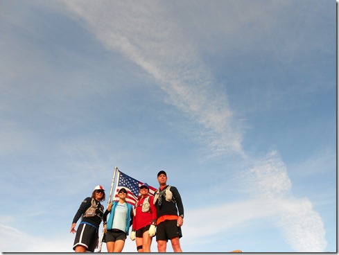
A better picture, vulture crags in background (photo compliments of Lisa):flag

Back on the run . . .

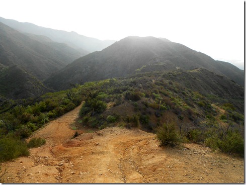
At some point on our run, I began to worry about whether I remembered how to get to “Old Camp.”  Tom Fangrow showed me “Old Camp,” probably the last time I ever ran Santiago Truck Trail.  I didn’t need to worry about paying attention to direction then, because I had Tom (who is familiar with just about every, if not every single, trail in the area).  I recalled a straight shot on Santiago Truck Trail to the place called “Old Camp.”  But then after several miles, the fire road continued straight onward, and off to the left ran a lonely single-track.  That single-track went in the direction I knew we needed to head, but I had NO recollection of a single-track to “Old Camp.”  I decided we should take it, because after all, we couldn’t get lost with the two peaks towering above us (Modjeska and Santiago).

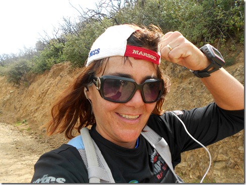
Picture compliments of Judi (I’m not sure what Lisa and I are discussing, but I’m pretty sure by the way I’m holding myself, that my problems told below are beginning):548054_2943305097297_1101323848_32343817_824608932_n

View from single-track (which I learned later with internet research, is still Santiago Truck Trail):

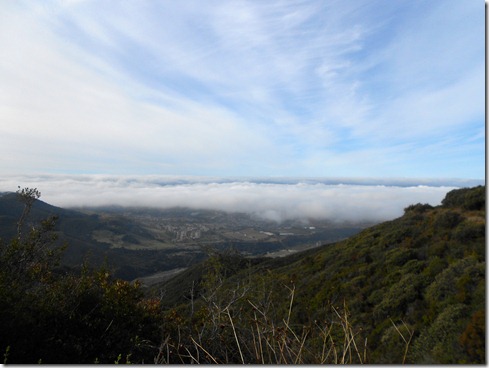
We kept climbing and climbing this single-track, and the more we ran upward, the more I doubted that we would make my original plans.  I knew we’d make the Main Divide however, so I wasn’t worried.  Thing was, I really wanted to see “Old Camp.”  And then suddenly while running this unfamiliar trail, I got a quick flashback of my run way-back-when with Tom, and for a second, it all looked familiar.  BUT WE CONTINUED CLIMBING.  Then I saw Lisa stop up ahead, and I wondered if she had come to a fork.  That’s what we trail runners do.  If we’re running someone else’s run (meaning, we don’t know the particular trails, we stop at forks and wait for everyone).  I hollered out, “Is there another trail?”  Lisa nodded and I felt exhilarated.  Upon full view, I KNEW.  I hundred percent recognized our location, one fork went up, the other went down.  We were on our way to “Old Camp!” Downhill we ran into a different world, a world of lush green and shade.

Lupin on the road to “Old Camp.”

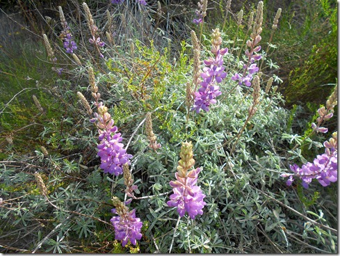
And then finally, after about eleven miles of running we came upon “Old Camp,” where we met several hikers relaxing beneath an old giant tree near a firepit.  The reprieve and conversation with these hikers was a delight.  We refueled.  And we talked trails.  I asked one of the hikers the name of the trail we just ran in on.  He replied, “I don’t know, I just call it the trail to “Old Camp.”  That comment made the moment even more joyous for me. 

“Old Camp”:

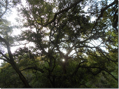
Picture compliments of Lisa:536503_10150631775801777_690331776_9777049_1383938027_n

Creek that runs along Old Camp, the one we will partially follow up our next trail:
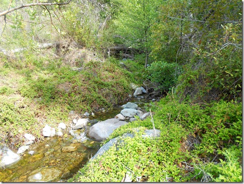
Woodpeckers’ work:

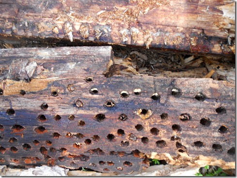
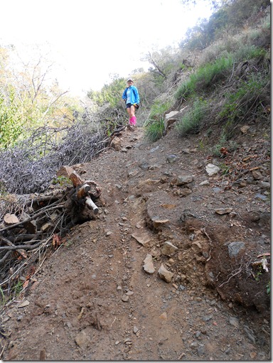
Some point during this run, and I don’t recall when, my stomach began acting up.  At first it ached just a little.  But as time went on, it worsened.  It felt like my insides were twisting into double knots.  I thought a pit stop might help.  It did not.  I’m unsure whether I should even put it in at this point in this post, because what occurred next on the run, tops the stomach problems.  And that was JOPLIN TRAIL.  I’ve never run Joplin Trail.  It’s single-track, green with gigantic trees.  There’s a lovely creek flowing heavily along the side (at first).  And IT. IS. STEEP.  Most of this trail, I was able to keep my mind off my stomach pain.  You know why?  Because this trail was so dang difficult, that I had to focus hard on simply continuing upward.  Travelling Joplin included very little running.  I grabbed at branches to help me along.  I STOPPED to rest.  And there came a point when I just didn’t care whether it took me an hour to travel one inch.  I just wanted to move forward and get this trail that put West Horsethief to shame FINISHED. 

Every time the trail headed downward I groaned.  Going down meant only that some of the elevation that we had gained was lost. 

Creek Crossing on Joplin Trail (picture compliments Matt):542341_2943309177399_1101323848_32343821_365796845_n

Lisa tells us that it’s getting a little steep (LOL):

More of Joplin Trail:

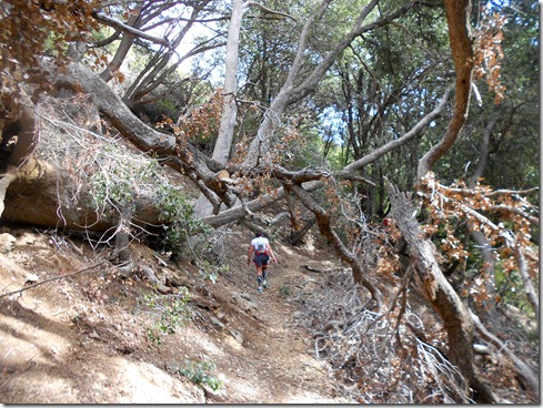
At times we could see Santiago Peak.  Its towers seemed a stone’s throw away.  Even with the peak so blazingly above us, Joplin trail would JUST NOT END.  My garmin didn’t even read a pace.  When it seldom did, it would give me a 26 minute pace, or something absurd like that.  With my stomach worsening, my mind simply went blank as I just put one foot in front of the other, knowing EVENTUALLY my feet would get me there.  And then, I heard a truck.  A truck!!!  A few minutes later I heard Judi holler out in joy.  And just like that, I was there – on The Main Divide at last!!!

It’s NO WONDER I hadn’t heard much about this trail:

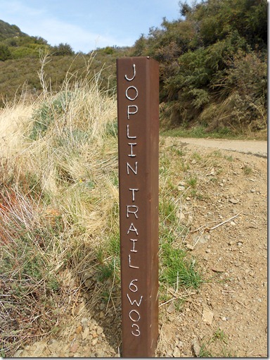
Looking back from the top of Joplin:

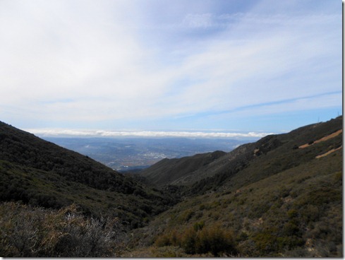
Though overwhelmed with joy, my stomach pain was becoming unbearable.  I tried not to grimace.  But I did run, though slowly it was.  I was afraid to eat, fearful I would make the pain worse.  I did drink up which did nothing to comfort my stomach, though at least I was sure to get my electrolytes and fluids (I put Nuun tablets in my water).  When we came up to The Main Divide, we were closer to Santiago Peak than Modjeska Peak.  So we still had to run to Modjeska.  Our spirits were up from finally having finished Joplin.  Our next “landmark” was “Four Corners.” It couldn’t come fast enough.  But it didn’t come fast for me.  It took F O R E V E R.  Each step I ran made the pain worse.

Look!  There’s still snow on The Main Divide:

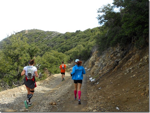
Matt and Lisa were waiting at “Four Corners.”  Actually, Lisa had run off a little bit to look for some water stash.  She found some, but such a small amount that she didn’t feel right taking it.  Fortunately, the next 9+ miles was down hill – Harding Truck Trail.

My pain was immense.  I told the group how to get down, that there was no way to get lost, just stay on the road.  I didn’t want them to wait for me, because I was going to be slow.  At one point I caught them because they had stopped in the road to talk to a wonderful woman they met running up.  She was over 70 years old, and she was still doing ultra runs.  She had run all the “bucket list” runs out our way.  And not just once, some of them 12, 13, 14 times.  While she was such a delight, her smile a piece of sunshine, I could hardly stand there.  I was literally doubling over in pain.  I tried not to let on as we took in her stories.  But finally, I could no longer stand, and though I just wanted to plop my butt down in the dirt, I leaned over, holding myself by my knees.  Occasionally, I’d squat down with my guts twisting and burning and stabbing at my stomach.  I really wanted to hear the conversation – I didn’t want to be “the wet rag.” Though I smiled and laughed with the group, I wanted more than anything to take off running for a head start.  I knew there was no possible way that I was going to be able to keep up with the group. 

As we headed off, we all kind of widened out, as is customary on group runs.  I chatted with Lisa a bit, and told her again, don’t wait for me – it’s going to take a long time for me to run down.  You see, running really knocked my insides around causing a great deal of pain.  Eventually, I phoned my husband to tell him.  And he wasn’t too happy that I told everyone to run ahead.  Thing was, I felt like I might vomit.  And even if I didn’t upchuck, my pain had reached a peak so terrible, I was no kind of company.  Besides, I knew that trail well, and it was practically crowded with hikers.  So, if anything did happen to me, someone would be around to witness and possibly call for help.

I lost connection with my husband.  So I ran a bit for another cell connection and phoned him again to ensure him nothing had happened.  He thought I had hung up to vomit.  Surprised smile  Here was my dilemma.  The only way to ease my pain was to walk.  Running made the pain worse.  But I WANTED THIS RUN OVER.  So, I ran.  I didn’t run fast.  But I ran.  And I forced myself not to look at the garmin because if I did, time would crawl by EVEN SLOWER down this giant switch-back trail. 

Eventually my three running friends were nowhere in sight.  And I plugged away at this run, telling myself, “You’re tough.  You can do it.”  I never cried.  I never stopped (except for the phone calls) and I didn’t even fall (though I tripped once.)  I even took a few pictures.

Scenes from Harding Truck Trail:

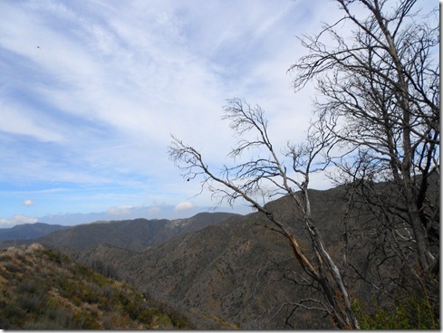
I really don’t have a moral to this story yet.  Maybe you can think of one.  I will add one little tid-bit.  With about two miles remaining, I FINALLY spotted Judi and Matt.  They were about a half mile off.  Judi screamed out, waving her arms above her head.  When I saw those two, I almost started crying.  It felt so good to finally see some friendly faces.   They were so, so kind in their words to me.  We had fun conversation on the way back to our cars.  Back at the truck I found a sweet note from Lisa on my door window.  I was very glad for that note.  It meant she made it safely.   Despite everything, it was a great day in many ways.

Picture of me running up to Judi and Matt (this picture means a lot to me – thanks Judi for taking it!):559215_2943311177449_1101323848_32343825_81049707_n

The Profile:My Activities Santiago Old Camp Joplin Main Divide Harding loop 3-24-2012, Elevation - Distance

Update: 

Today, a day later, my stomach is still having problems, but it’s barely noticeable.  Also, come to find out, my oldest and middle sons had stomach problems on Saturday as well.  Fortunately, they did not fare as badly, as their pain lasted only a couple hours.  Also, I could not get enough sleep after this run.  And I ached all over, as if I was in a car accident (you know, not a terrible car accident, but I’ve been in a few accidents and my body feels similar – aching in the oddest places).  And lastly, I’m already wondering when I can do this run again.  Muhahahaha. 

Oh!  And one more thing.  I just found the entry for my original run to “Old Camp” with Tom back in July 2009.  http://laurenontherun.blogspot.com/2009/07/slam-dancin-with-trail.html  After just reading this and looking at the pictures, my memory did not serve me right at all!  How silly of me not to read this post before Saturday’s run. Smile with tongue out