TALES FROM THE TRAIL (AND SOMETIMES THE ROAD TOO)

Friday, February 3, 2012

One-Track Mind

Day 46 of my longest running streak (by far):  6.42 easyish out-and-back miles run to Top of the World in Aliso/Wood Canyons.

Running up Cholla Trail:

View of Wood Canyon from Cholla:

Santiago Peak from West Ridge:

Pacific Ocean / Catalina Island view from Park Ave. Nature Trail:

Top of the World:

Santiago Peak from West Ridge:

Running back down Cholla Trail:

My Activities To Top of the World 2-3-2012, Elevation - Distance

Thursday, February 2, 2012

More on the Scout . . .

Day 45 of my running streak, I ran another scouting expedition in hopes of connecting trails to Trabuco Canyon.  It went pretty well, though the trails were pretty dang lonely.  (On the return trip, they livened up with cyclists and even two runners). 

This morning I began at the bridge, again running up Trabuco Ridge.  That cuts off about (5 or 6 miles) I believe, from a Doheny Beach starting point.  During today’s scouting expedition, I gave myself a couple hours to run toward Saddleback Mountains and soon found myself in familiar territory, Arroyo Trabuco Trail.  When I reached my hourly limit, I simply turned around and ran back. 

This run really wiped me out.  But fortunately, I ran a “negative split” (Yah, I’m picking up some terminology) and had lots of time to stretch afterward.

The Pictorial (Warning – way too many pictures.  I’ll try & lighten up a little bit next time):

So far, I’ve run from my truck to the bridge which crosses the creek and meets up with Trabuco Ridge Trail:

Heading down off the trail to pick it up at the end of upcoming cul-de-sac:

I don’t know what these are, they stand up above golf course about a mile before I begin to descend back down to creek:

You guessed it (if you’ve been to this blog before) – Santiago Peak in distance:

Trailside flowers:

Heading down to the creek, a 1/2 mile to 1 mile before Crown Valley Parkway underpass:

Ahhhhh.  The creek.  I ran the single track to the right for a while before meeting up with Arroyo Trabuco Trail:

Relieved that I know where I’m at.  LOL:

Running along Trabuco Trail, I hear all sorts of noises in the leaf litter:

Looking downstream before crossing:

Closed???? 

Ah.  I don’t think so!

Arroyo Trabuco – I recognize this trail!!  Hooray!  I’m not getting lost today. Smile

More creek crossing – I’ve crossed here many times on different runs:

Got a little spooky in here.  I  couldn’t even see the mountains.  So I took the headphones off to listen closely and focus:

Heading back to the truck, running Trabuco Ridge I notice a fine specimen of Ladybug.  I love Ladybugs:

Truckward bound and oh, so tired:

16.02 miles ran this morning (25.78 km):Trabuco Ridge to Arroyo Trabuco Trail 2-2-2012, Elevation - Distance

Wednesday, February 1, 2012

Scouting Expedition

Day 44 of my running streak, I decided to run a scouting expedition.  I went dressed for running to a work meeting.  And directly afterward, I ran straight out to Trabuco Trail about 1.5 miles away for this scouting expedition.

Ever since I started investigating the trails along San Juan and Trabuco Creek, I had this idea of an epic run (an idea that was run by me a couple times by my old running partner, Tom.)  But when I finally found Trabuco Trail about a year ago and saw that it was closed, I put the idea aside.  Then the other day, while running around San Juan Capistrano, I saw that a new trail had been constructed just above Trabuco Trail.  I thought to myself – indeed the epic run is alive!

My idea is to run from the beach to the peak – that is Doheny Beach to Santiago Peak.  I’m sure it’s been done before, yet I can’t find specific information on the internet about such a run.  I have no idea how many miles the route is.  But I do know that it would probably be my most difficult run to date.  And I do know that it’s a bit crazy.  I’m even kind of afraid to try and get a group or even a single person to join me, because I have my reputation you know.  LOL.  But I do know without trail closures, a trail run from Doheny to Santiago Peak is possible.  And so, today I ran that new Trabuco Trail with the limited time I had to scout it out.

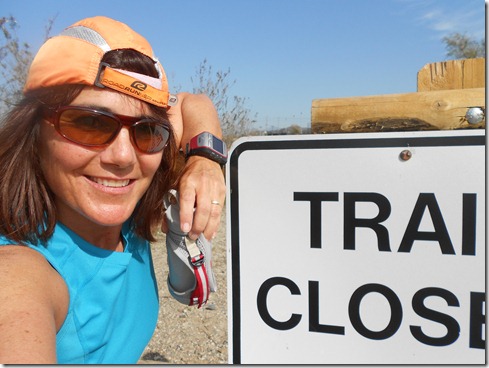
So, I took off on the “old” Trabuco Trail and struck a pose in front of the “closed” sign I soon ran up on:

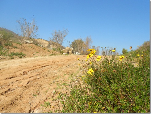
And I took the new, upper-trail.  It doesn’t run along the creek, and I could see the “old” trail below, which looked in good condition to me.  The lower closed trail was natural and kind of rugged.  The new trail was groomed with wood chips and moved alongside a private school.  The kids were at lunch, some were in P.E. class.  Lots of the children waved.

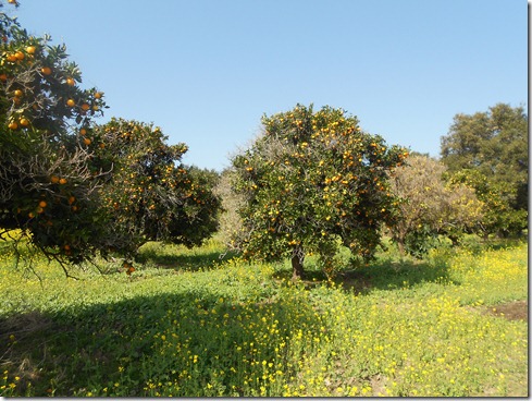
After crossing the creek, I made my way to the original trail.  It meandered through mustard plant fields, then to my utter delight, an orange grove.  I could hear the cars speeding by on the freeway a few hundred yards away.  The trail had no climbing and was quite tranquil despite the freeway.  There was nothing technical about it, no hills, ruts, rocks or gulleys, but it was still beautiful.

Then the trail turned right.  I ran beneath both the southbound and northbound Interstate 5 Freeways.  It was dark, loud, long (I’d guess 8 to 10 lanes worth) and quite eerie.  But I could see the “light at the end of the tunnel” and looked forward to discover where I’d come out.

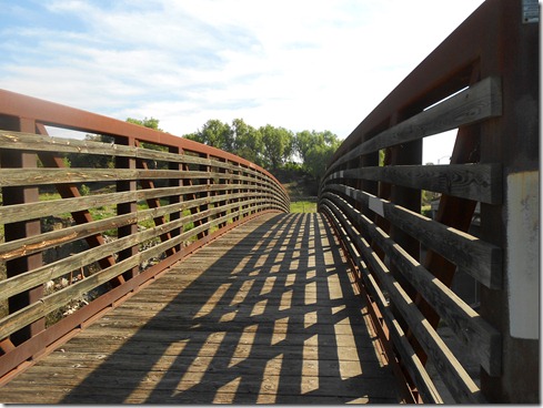
To my great surprise I came out at the bridge pictured below.  I’ve driven past it hundreds of times and have always thought, “That’s an odd place for a bridge.”  Ms. Trail Runner didn’t even think that it might cross the creek TO CONNECT TRAILS!  I had actually thought it was an old, possibly abandoned, unused bridge.  Funny girl. 

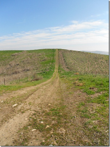
At the end of the bridge there were 2 trails to choose from.  I chose the one that went up and had the word “Trabuco” in it.  I ran Trabuco Ridge.  Again, the trail was uneventful, easy running rolling hills (well, all were not that easy, but it’s all relative right?)  Soon I ran high above the freeways and I could see that I was passing Saddleback College in Mission Viejo on my far left. 

I ran up and down these grassy hills, coming across only two other people.  They sat together on the grass beneath an umbrella in practically the middle of nowhere.  We all smiled and waved as I passed.  I noticed that they were drinking water  – perhaps something else, I mean what the heck were they doing there???  LOL. 

There she is!  Santiago Peak:

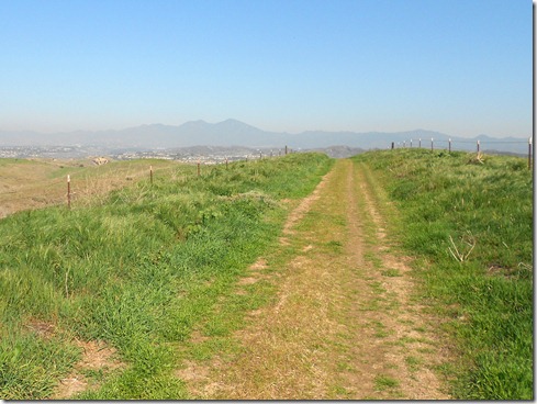
Eventually, I had to turn back because I needed to pick the boys up from school.  On the return trip I spied four deer frolicking on the hillside.  If you look closely in the picture below, you might see them.  (You might have to click the picture for a larger view).

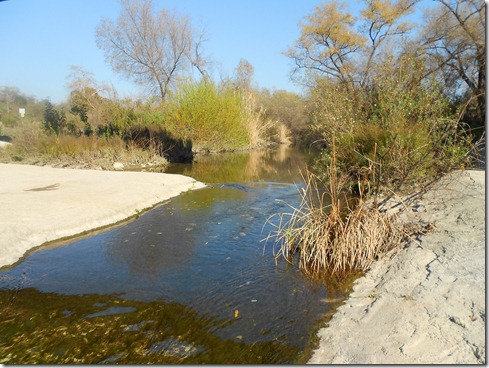
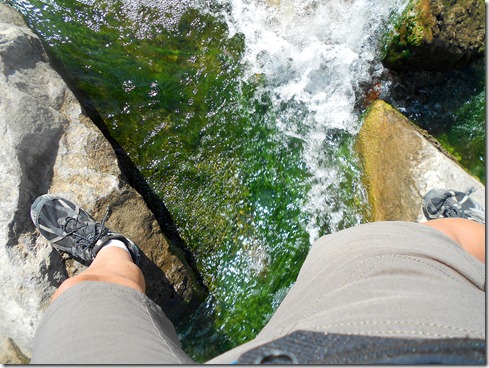
Making better time than I expected, I took the time for some photo ops while  crossing Trabuco Creek:

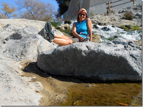
No, I’m not dancing.  I’m trying to sit down in time before the camera clicks:

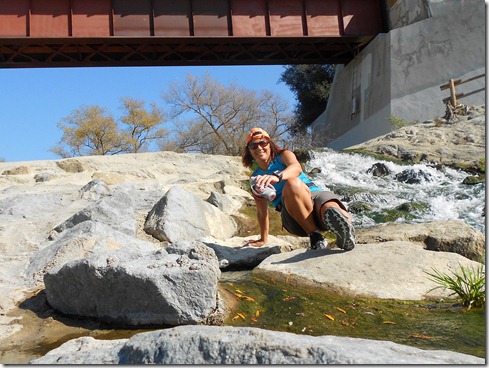
And then I crossed the creek and ran back to my car parked at my work for a run totaling 8.40 miles (13.52 km).
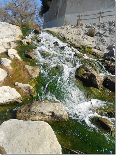
Trabuco Creek:

Tuesday, January 31, 2012

It’s All Relative

I felt much stronger on day 43 of Streaking into the New Year than I did for day 42.  Perhaps it’s because today is the official end of Streaking into the New Year.  I doubted that I could run every day until January 31.  Now, I’m so close to a 50 day streak, that I’m going to try to go on a little longer.

Today I sang on the way to the trails.  The weather was cool.  And I was so thrilled to hit the dirt again.  I took off in Aliso Canyon with a dozen or so plump squirrels scampering across the trail.  A gopher poked his head out of a hole as I hopped over it. 

I focused on form while keeping my pace way up from yesterday.  After running into Wood Canyon Trail, I took a quick right onto Meadows Trail, lovely Meadows Trail:

I’ll tell you, the difficulty of hills is surely relative – pretty much like most everything (at least in physics anyway).  A bit off subject here, but there was a time when mankind thought that we would surely die travelling on a train.  It was simply too fast, we couldn’t take it.  Turned out, we when sit in a train or a car or a plane, though we’re travelling the same speed as the “vehicle”, it doesn’t feel like it.  It feels like our bodies aren’t even moving at all.  Similarly, there was a time when I thought I would surely die running up Meadows Trail.  LOL.  Even though I sweated running up it this morning, and the journey was hard, it was definitely easy, relative to some of the trails I’ve been putting myself through.  I force myself to “run” the toughest trails.  Now when I run up Meadows, I wear a wide smile like this:

The smile of course is also because of views like this:

And dried flowers like this:

When I hit the top, I kept on running.  I ran on through the neighborhoods until I reached Top of the World.  I stopped momentarily to fuel and took off so quickly that I forgot to snap a photo of Top of the World.  It’s my custom to take a photo of Top of the World.  The fact that I forgot shows how much I enjoyed the moment on this run, how I enjoyed feeling strength. 

I ran all the off-shoots on West Ridge Trail so that I could get more elevation.  Only one of those off-shots is named:  Park Avenue Nature Trail.  I came upon several cyclists, hikers and runners along the rolling ridge.  They were all mostly smiling.  And though it grew warm enough to take off my sleeves, the weather remained cool for the remainder of this spectacular trail run. 

Sometimes when I reach Cholla Trail (the trail at the end of West Ridge), I am exasperated.  Today I felt gleeful with views like this of Wood Canyon running down Cholla:

At the bottom of Cholla I decided to run the canyon all the way and not take the parallel trails like I usually do because I missed wide tranquil trails like this:

With creek views like this:

And I was nostalgic for Sycamore Grove now covered with the parasite Mistletoe.  Yes, those clumps of green in this deciduous tree are Mistletoe.  So be careful who you stand beneath these trees with:

I continued focusing on form, but more so on keeping the pace up.  I still needed to do some grocery shopping before returning home.  Though I kept an eye on these beautiful pastures, I kept the kick out the back quick and made it back to the truck exactly when I planned:

12.14 miles ran today (19.54 km):My Activities Big Loop up Meadows down Cholla 1-31-2012, Elevation - Distance

Monday, January 30, 2012

After 42 Consecutive Days . . .

After 42 consecutive days of running, I am not injured.  That is a hoot because I have often read that people over forty should not run every day, else risk injury.  It’s also a hoot  because prior to 2011 I was Ms. Injury.  Keep in mind that I have been working on my form, actually changed it back in early 2011.  And I’m still working on perfecting it.  I also stretch after every run.  I never stretch before I run.  I foam roll every day, and do some hip and glute exercises every day. 

After 42 consecutive days of running, my legs feel heavier, as in tighter and stronger, like they are harder with more muscle.  I occasionally have felt little aches along right IT band (always the right).  But have been able to “iron” them out over night (so far!).

After 42 consecutive days of running, I am tired.  I nap more often; sometimes twice a day.  I also consume way more calories than normal, and as such am fearful of the scale.

Today, I put in a nice and easy 5.09 miles running at the beach – very little running on the sand.  I ran mostly on asphalt and sidewalk all the way to where the sidewalk ends.  Then I turned around and ran home.

Surf & sand and a thousand birds

And this guy takes the lead . . .

“Where the sidewalk ends.”